

Hoher Meißner
A cycling route starting in Lindewerra, Thuringia, Germany.
Overview
About this route
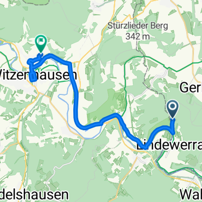
Start: Burg Ludwigstein via: Hoher Meißner, Bad Sooden Allendorf
Tour: 52km, 1050hm(cloned from route 3315509)
- -:--
- Duration
- 51.8 km
- Distance
- 929 m
- Ascent
- 929 m
- Descent
- ---
- Avg. speed
- ---
- Max. altitude
Route quality
Waytypes & surfaces along the route
Waytypes
Track
34.2 km
(66 %)
Path
4.7 km
(9 %)
Surfaces
Paved
15 km
(29 %)
Unpaved
31.6 km
(61 %)
Gravel
29.6 km
(57 %)
Asphalt
11.9 km
(23 %)
Continue with Bikemap
Use, edit, or download this cycling route
You would like to ride Hoher Meißner or customize it for your own trip? Here is what you can do with this Bikemap route:
Free features
- Save this route as favorite or in collections
- Copy & plan your own version of this route
- Sync your route with Garmin or Wahoo
Premium features
Free trial for 3 days, or one-time payment. More about Bikemap Premium.
- Navigate this route on iOS & Android
- Export a GPX / KML file of this route
- Create your custom printout (try it for free)
- Download this route for offline navigation
Discover more Premium features.
Get Bikemap PremiumFrom our community
Other popular routes starting in Lindewerra
 Hoher Meißner
- Distance
- 51.8 km
- Ascent
- 929 m
- Descent
- 929 m
- Location
- Lindewerra, Thuringia, Germany
 An der Liete 9, Bad Sooden-Allendorf nach An der Liete 9, Bad Sooden-Allendorf
- Distance
- 16.5 km
- Ascent
- 301 m
- Descent
- 301 m
- Location
- Lindewerra, Thuringia, Germany
 An der Liete 9, Bad Sooden-Allendorf nach An der Liete 9, Bad Sooden-Allendorf
- Distance
- 21.6 km
- Ascent
- 120 m
- Descent
- 120 m
- Location
- Lindewerra, Thuringia, Germany
 Lindewerra nach Bahnhofstraße 18, Duderstadt
- Distance
- 47.3 km
- Ascent
- 681 m
- Descent
- 651 m
- Location
- Lindewerra, Thuringia, Germany
 Ludwigstein - Duderstadt
- Distance
- 61 km
- Ascent
- 690 m
- Descent
- 742 m
- Location
- Lindewerra, Thuringia, Germany
 Quer durch's Land 16.Etappe Lindawerra - Witzenhausen
- Distance
- 14.1 km
- Ascent
- 125 m
- Descent
- 236 m
- Location
- Lindewerra, Thuringia, Germany
 Nov 222 ab Lindenwerra Walkenried
- Distance
- 90.8 km
- Ascent
- 1,579 m
- Descent
- 1,450 m
- Location
- Lindewerra, Thuringia, Germany
 Grünes Band DE 09/14: Lindewerra - Duderstadt
- Distance
- 60.5 km
- Ascent
- 946 m
- Descent
- 908 m
- Location
- Lindewerra, Thuringia, Germany
Open it in the app