

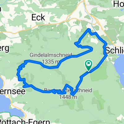
Schliersee zum Rotwand Haus
A cycling route starting in Schliersee, Bavaria, Germany.
Overview
About this route
Fahrtzeit: 2 3/4 bis 3 1/2 Std.
Niveau: Fortgeschritten
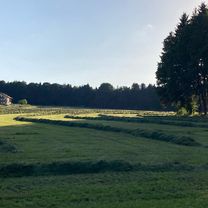
Schöne Herbstour um am Ende traumhafte Berg und Seeblicke zu genießen.
Auf den Hinweg über die alte Spitzingstraße hoch zum Spitzingsattel. Teilweise auf der neuen Straße. Den Trail bergauf zu fahren eher nicht zu empfehlen.
Auf dem Rückweg ab dem Spitzingsattel über den Wanderweg und Trail zurück auf die alte Spitzing Straße zurück.
Gegen Ende Steigungen / Rampen > 16%, teilweise kurz > 20%.
Fazit:
Weitgehend auch für Einsteiger als Herausforderung zu fahren. Gegen Ende aber anspruchsvoll. Die Belohung ist der tolle Blick vom Rotwandhaus und dass der Rückweg fast immer bergab geht.
Tipp:
Am Samstag fahren und nicht im Hochsommer. Danach im Hallenbad, entspannt den Blick auf die Brecherspitz vom Outdoor Solebad genießen.
- -:--
- Duration
- 38.3 km
- Distance
- 1,184 m
- Ascent
- 1,185 m
- Descent
- ---
- Avg. speed
- ---
- Max. altitude

Continue with Bikemap
Use, edit, or download this cycling route
You would like to ride Schliersee zum Rotwand Haus or customize it for your own trip? Here is what you can do with this Bikemap route:
Free features
- Save this route as favorite or in collections
- Copy & plan your own version of this route
- Sync your route with Garmin or Wahoo
Premium features
Free trial for 3 days, or one-time payment. More about Bikemap Premium.
- Navigate this route on iOS & Android
- Export a GPX / KML file of this route
- Create your custom printout (try it for free)
- Download this route for offline navigation
Discover more Premium features.
Get Bikemap PremiumFrom our community
Other popular routes starting in Schliersee
 Valepprunde
- Distance
- 44.9 km
- Ascent
- 1,034 m
- Descent
- 1,031 m
- Location
- Schliersee, Bavaria, Germany
 Triathlonstrecke Hexal Alpentriathlon
- Distance
- 40 km
- Ascent
- 817 m
- Descent
- 491 m
- Location
- Schliersee, Bavaria, Germany
 Schliersee nach Mühlthal, Valley
- Distance
- 18.3 km
- Ascent
- 314 m
- Descent
- 491 m
- Location
- Schliersee, Bavaria, Germany
 Schliersee - Tegernsee
- Distance
- 23.2 km
- Ascent
- 925 m
- Descent
- 925 m
- Location
- Schliersee, Bavaria, Germany
 Hexal Alpen-Triathlon Radstrecke
- Distance
- 39.4 km
- Ascent
- 734 m
- Descent
- 526 m
- Location
- Schliersee, Bavaria, Germany
 Let's kill the Hill
- Distance
- 136.6 km
- Ascent
- 1,317 m
- Descent
- 1,316 m
- Location
- Schliersee, Bavaria, Germany
 Gindelalm
- Distance
- 34.3 km
- Ascent
- 1,139 m
- Descent
- 1,139 m
- Location
- Schliersee, Bavaria, Germany
 Dreiseenrunde Schliersee-Tegernsee-Spitzingsee
- Distance
- 52.3 km
- Ascent
- 771 m
- Descent
- 765 m
- Location
- Schliersee, Bavaria, Germany
Open it in the app