

A Mayrhofen 45 rovina
A cycling route starting in Mayrhofen, Tyrol, Austria.
Overview
About this route
Mtb
- -:--
- Duration
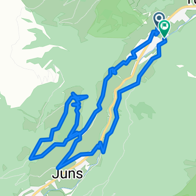
- 43.9 km
- Distance
- 176 m
- Ascent
- 175 m
- Descent
- ---
- Avg. speed
- ---
- Max. altitude
Route quality
Waytypes & surfaces along the route
Waytypes
Track
19.3 km
(44 %)
Quiet road
11.9 km
(27 %)
Surfaces
Paved
25.9 km
(59 %)
Unpaved
7.9 km
(18 %)
Asphalt
22.8 km
(52 %)
Gravel
4.4 km
(10 %)
Continue with Bikemap
Use, edit, or download this cycling route
You would like to ride A Mayrhofen 45 rovina or customize it for your own trip? Here is what you can do with this Bikemap route:
Free features
- Save this route as favorite or in collections
- Copy & plan your own version of this route
- Sync your route with Garmin or Wahoo
Premium features
Free trial for 3 days, or one-time payment. More about Bikemap Premium.
- Navigate this route on iOS & Android
- Export a GPX / KML file of this route
- Create your custom printout (try it for free)
- Download this route for offline navigation
Discover more Premium features.
Get Bikemap PremiumFrom our community
Other popular routes starting in Mayrhofen
 Ahornstraße 855, Mayrhofen nach Stillup 967, Mayrhofen
- Distance
- 15.4 km
- Ascent
- 881 m
- Descent
- 94 m
- Location
- Mayrhofen, Tyrol, Austria
 Zillert Höhenstr1
- Distance
- 41.5 km
- Ascent
- 1,488 m
- Descent
- 1,486 m
- Location
- Mayrhofen, Tyrol, Austria
 Lanersbach nach Lanersbach
- Distance
- 14.6 km
- Ascent
- 876 m
- Descent
- 877 m
- Location
- Mayrhofen, Tyrol, Austria
 MTB-Alpencross Tegernsee - Villanders bei Bozen - Etappe 3: Ginzling-Schabs
- Distance
- 71.3 km
- Ascent
- 1,311 m
- Descent
- 1,560 m
- Location
- Mayrhofen, Tyrol, Austria
 A Mayrhofen 45 rovina
- Distance
- 43.9 km
- Ascent
- 176 m
- Descent
- 175 m
- Location
- Mayrhofen, Tyrol, Austria
 Rundfahrt Pinzgau - Brixental und Zillertal
- Distance
- 179.6 km
- Ascent
- 2,268 m
- Descent
- 2,322 m
- Location
- Mayrhofen, Tyrol, Austria
 Tortour de Zillertal
- Distance
- 147.2 km
- Ascent
- 3,072 m
- Descent
- 3,072 m
- Location
- Mayrhofen, Tyrol, Austria
 Mayrhofen Adlerblick and back 27/8/19
- Distance
- 42.3 km
- Ascent
- 1,567 m
- Descent
- 1,567 m
- Location
- Mayrhofen, Tyrol, Austria
Open it in the app