

Recording from 1 novembre 10:29
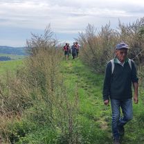
A cycling route starting in Saint-Félicien, Auvergne-Rhône-Alpes, France.
Overview
About this route
- 2 h 20 min
- Duration
- 27.3 km
- Distance
- 377 m
- Ascent
- 414 m
- Descent
- 11.7 km/h
- Avg. speed
- ---
- Max. altitude

Route quality
Waytypes & surfaces along the route
Waytypes
Quiet road
1.6 km
(6 %)
Access road
0.8 km
(3 %)
Undefined
24.8 km
(91 %)
Surfaces
Paved
4.6 km
(17 %)
Unpaved
0.5 km
(2 %)
Asphalt
4.6 km
(17 %)
Gravel
0.5 km
(2 %)
Undefined
22.1 km
(81 %)
Continue with Bikemap
Use, edit, or download this cycling route
You would like to ride Recording from 1 novembre 10:29 or customize it for your own trip? Here is what you can do with this Bikemap route:
Free features
- Save this route as favorite or in collections
- Copy & plan your own version of this route
- Sync your route with Garmin or Wahoo
Premium features
Free trial for 3 days, or one-time payment. More about Bikemap Premium.
- Navigate this route on iOS & Android
- Export a GPX / KML file of this route
- Create your custom printout (try it for free)
- Download this route for offline navigation
Discover more Premium features.
Get Bikemap PremiumFrom our community
Other popular routes starting in Saint-Félicien
 ARDECHOISE 2011 la Volcanique
- Distance
- 169 km
- Ascent
- 2,701 m
- Descent
- 2,701 m
- Location
- Saint-Félicien, Auvergne-Rhône-Alpes, France
 Parcours détendu
- Distance
- 5.3 km
- Ascent
- 221 m
- Descent
- 243 m
- Location
- Saint-Félicien, Auvergne-Rhône-Alpes, France
 pailhares marchand vaudevant
- Distance
- 38.1 km
- Ascent
- 765 m
- Descent
- 763 m
- Location
- Saint-Félicien, Auvergne-Rhône-Alpes, France
 L'Ardéchoise 2013 - La Méridionale - Pas du Loup
- Distance
- 521.8 km
- Ascent
- 4,695 m
- Descent
- 4,695 m
- Location
- Saint-Félicien, Auvergne-Rhône-Alpes, France
 Chantelermuze 2025-09 La Bonnefont
- Distance
- 10.1 km
- Ascent
- 416 m
- Descent
- 413 m
- Location
- Saint-Félicien, Auvergne-Rhône-Alpes, France
 Montpoulet-Beaulieu 43800
- Distance
- 97.9 km
- Ascent
- 2,764 m
- Descent
- 2,723 m
- Location
- Saint-Félicien, Auvergne-Rhône-Alpes, France
 De Chemin de Montpoulet 800, Saint-Victor à Chemin de Montpoulet 800, Saint-Victor
- Distance
- 31.8 km
- Ascent
- 663 m
- Descent
- 659 m
- Location
- Saint-Félicien, Auvergne-Rhône-Alpes, France
 col du Buisson Col du Faux Col du Marchand Col de Fontailles avec le club
- Distance
- 49 km
- Ascent
- 728 m
- Descent
- 731 m
- Location
- Saint-Félicien, Auvergne-Rhône-Alpes, France
Open it in the app