

Peña del Aguila
A cycling route starting in Alcantud, Castille-La Mancha, Spain.
Overview
About this route
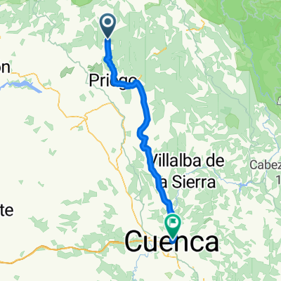
From Alcantud, we climb to Pozuelo and return via Carrascosa and the Herrería de Santa Cristina. With a spectacular landscape.
- -:--
- Duration
- 47.2 km
- Distance
- 775 m
- Ascent
- 775 m
- Descent
- ---
- Avg. speed
- ---
- Max. altitude
Route quality
Waytypes & surfaces along the route
Waytypes
Track
33 km
(70 %)
Road
12.7 km
(27 %)
Surfaces
Paved
1.9 km
(4 %)
Unpaved
31.6 km
(67 %)
Gravel
12.3 km
(26 %)
Loose gravel
10.4 km
(22 %)
Route highlights
Points of interest along the route

Photo after 6.1 km
Mirador de Cerro Caballo

Photo after 26.8 km
Mirador de la Peña del Aguila

Photo after 41.5 km
Inscripción Romana
Continue with Bikemap
Use, edit, or download this cycling route
You would like to ride Peña del Aguila or customize it for your own trip? Here is what you can do with this Bikemap route:
Free features
- Save this route as favorite or in collections
- Copy & plan your own version of this route
- Sync your route with Garmin or Wahoo
Premium features
Free trial for 3 days, or one-time payment. More about Bikemap Premium.
- Navigate this route on iOS & Android
- Export a GPX / KML file of this route
- Create your custom printout (try it for free)
- Download this route for offline navigation
Discover more Premium features.
Get Bikemap PremiumFrom our community
Other popular routes starting in Alcantud
 cuenca - 3
- Distance
- 168.7 km
- Ascent
- 1,775 m
- Descent
- 1,737 m
- Location
- Alcantud, Castille-La Mancha, Spain
 alcantud-pozuelo por camino forestal
- Distance
- 19.2 km
- Ascent
- 571 m
- Descent
- 184 m
- Location
- Alcantud, Castille-La Mancha, Spain
 Alcantud - El Pozuelo
- Distance
- 12.8 km
- Ascent
- 473 m
- Descent
- 94 m
- Location
- Alcantud, Castille-La Mancha, Spain
 76 Alcantud -Cuenca
- Distance
- 98.6 km
- Ascent
- 1,024 m
- Descent
- 866 m
- Location
- Alcantud, Castille-La Mancha, Spain
 EL POZUELO, por Alcantud
- Distance
- 6.5 km
- Ascent
- 433 m
- Descent
- 36 m
- Location
- Alcantud, Castille-La Mancha, Spain
 Peña del Aguila
- Distance
- 47.2 km
- Ascent
- 775 m
- Descent
- 775 m
- Location
- Alcantud, Castille-La Mancha, Spain
 SORTIDA ALCANTUD-CUENCA
- Distance
- 71.2 km
- Ascent
- 722 m
- Descent
- 614 m
- Location
- Alcantud, Castille-La Mancha, Spain
Open it in the app