

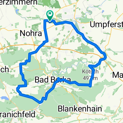
Weimar - Kahla (Leuchtenburg
A cycling route starting in Hopfgarten, Thuringia, Germany.
Overview
About this route
- -:--
- Duration
- 91.1 km
- Distance
- 752 m
- Ascent
- 752 m
- Descent
- ---
- Avg. speed
- ---
- Max. altitude

Continue with Bikemap
Use, edit, or download this cycling route
You would like to ride Weimar - Kahla (Leuchtenburg or customize it for your own trip? Here is what you can do with this Bikemap route:
Free features
- Save this route as favorite or in collections
- Copy & plan your own version of this route
- Split it into stages to create a multi-day tour
- Sync your route with Garmin or Wahoo
Premium features
Free trial for 3 days, or one-time payment. More about Bikemap Premium.
- Navigate this route on iOS & Android
- Export a GPX / KML file of this route
- Create your custom printout (try it for free)
- Download this route for offline navigation
Discover more Premium features.
Get Bikemap PremiumFrom our community
Other popular routes starting in Hopfgarten
 Nördlich von Weimar
- Distance
- 31.2 km
- Ascent
- 312 m
- Descent
- 173 m
- Location
- Hopfgarten, Thuringia, Germany
 Weima Rosslau
- Distance
- 165.3 km
- Ascent
- 557 m
- Descent
- 752 m
- Location
- Hopfgarten, Thuringia, Germany
 Weimar - Kahla (Leuchtenburg
- Distance
- 91.1 km
- Ascent
- 752 m
- Descent
- 752 m
- Location
- Hopfgarten, Thuringia, Germany
 Anbiken 2010
- Distance
- 23.6 km
- Ascent
- 177 m
- Descent
- 169 m
- Location
- Hopfgarten, Thuringia, Germany
 Rund um Erfurt mit dem MTB
- Distance
- 90.4 km
- Ascent
- 439 m
- Descent
- 435 m
- Location
- Hopfgarten, Thuringia, Germany
 03042010 MB Training
- Distance
- 50.3 km
- Ascent
- 698 m
- Descent
- 735 m
- Location
- Hopfgarten, Thuringia, Germany
 MTB Südwestlich von Weimar
- Distance
- 36.8 km
- Ascent
- 432 m
- Descent
- 432 m
- Location
- Hopfgarten, Thuringia, Germany
 Weimar - Bad Berka Paulinen Turm Kötsch CLONED FROM ROUTE 1283125
- Distance
- 49 km
- Ascent
- 568 m
- Descent
- 568 m
- Location
- Hopfgarten, Thuringia, Germany
Open it in the app