

Rekawinkel - Wien OSV
A cycling route starting in Eichgraben, Lower Austria, Austria.
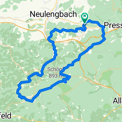
Overview
About this route
Rekawinkel - Pfalzau - Wolfsgraben - Heimbautal - Dambachstrecke - Auhof - Ober-St.-Veit
- -:--
- Duration
- 30.1 km
- Distance
- 543 m
- Ascent
- 632 m
- Descent
- ---
- Avg. speed
- ---
- Max. altitude
Continue with Bikemap
Use, edit, or download this cycling route
You would like to ride Rekawinkel - Wien OSV or customize it for your own trip? Here is what you can do with this Bikemap route:
Free features
- Save this route as favorite or in collections
- Copy & plan your own version of this route
- Sync your route with Garmin or Wahoo
Premium features
Free trial for 3 days, or one-time payment. More about Bikemap Premium.
- Navigate this route on iOS & Android
- Export a GPX / KML file of this route
- Create your custom printout (try it for free)
- Download this route for offline navigation
Discover more Premium features.
Get Bikemap PremiumFrom our community
Other popular routes starting in Eichgraben
 Tour R10
- Distance
- 13.5 km
- Ascent
- 343 m
- Descent
- 491 m
- Location
- Eichgraben, Lower Austria, Austria
 Eichgraben-Hochstrass
- Distance
- 21.1 km
- Ascent
- 520 m
- Descent
- 520 m
- Location
- Eichgraben, Lower Austria, Austria
 Grosse Schoepflrunde
- Distance
- 61.6 km
- Ascent
- 1,223 m
- Descent
- 1,225 m
- Location
- Eichgraben, Lower Austria, Austria
 Eichgraben - Schöpfl - Peilstein - Parapluiberg -Ober St_Veit
- Distance
- 73.1 km
- Ascent
- 1,531 m
- Descent
- 1,643 m
- Location
- Eichgraben, Lower Austria, Austria
 Kleine Schöpfelrunde
- Distance
- 48.1 km
- Ascent
- 887 m
- Descent
- 890 m
- Location
- Eichgraben, Lower Austria, Austria
 Rekawinkel - Wien OSV
- Distance
- 30.1 km
- Ascent
- 543 m
- Descent
- 632 m
- Location
- Eichgraben, Lower Austria, Austria
 kurz runderl bad
- Distance
- 12.8 km
- Ascent
- 347 m
- Descent
- 347 m
- Location
- Eichgraben, Lower Austria, Austria
 Rekawinkel-Neulengbach-Tulln-Klosterneuburg-Thalia
- Distance
- 73.8 km
- Ascent
- 77 m
- Descent
- 234 m
- Location
- Eichgraben, Lower Austria, Austria
Open it in the app