

B29 Über den Mummelsee auf die Hornisgrinde
A cycling route starting in Seebach, Baden-Wurttemberg, Germany.
Overview
About this route
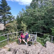
The starting point of this circular hike is at the managed mountain hut Seibelseckle. The path leads a stretch along the Westweg towards Mummelsee. After about 1.5 km of gentle ascent, you reach Mummelsee. Continuing over Katzenkopf, the climb continues up to Hornisgrinde. The Hornisgrindeturm offers a stunning view over the heights of the Black Forest. The high moor is traversed via the very informative nature conservation path from the Ruhestein Nature Conservation Center. It passes by the Bismarck Tower, another viewing platform. After the Bismarck Tower, the route crosses through the high moor area via a wooden path. At the Dreifürstenstein location, you are at the highest point of the Northern Black Forest. The return march follows through Kieneck, Hinterer Brand, Untergrinden back to Seibelseckle. There are dining options at the start and endpoint as well as at Mummelsee.
- -:--
- Duration
- 8.3 km
- Distance
- 302 m
- Ascent
- 304 m
- Descent
- ---
- Avg. speed
- ---
- Max. altitude
Route highlights
Points of interest along the route
Point of interest after 1.5 km
Der See zählt zu den meistbesuchten Seen in Baden-Württemberg, da er direkt an der Schwarzwaldhochstraße liegt. Um den Mummelsee, der in der Vergangenheit einst in tiefer Einsamkeit lag, ranken sich etliche Sagen. Einer Sage nach lebte in dem See eine Nixe, welche den Menschen nachts Hilfe gewährte
Point of interest after 3.4 km
Die Hornisgrinde ist mit 1164 Metern höchster Berg im nördlichen Schwarzwald.
Continue with Bikemap
Use, edit, or download this cycling route
You would like to ride B29 Über den Mummelsee auf die Hornisgrinde or customize it for your own trip? Here is what you can do with this Bikemap route:
Free features
- Save this route as favorite or in collections
- Copy & plan your own version of this route
- Sync your route with Garmin or Wahoo
Premium features
Free trial for 3 days, or one-time payment. More about Bikemap Premium.
- Navigate this route on iOS & Android
- Export a GPX / KML file of this route
- Create your custom printout (try it for free)
- Download this route for offline navigation
Discover more Premium features.
Get Bikemap PremiumFrom our community
Other popular routes starting in Seebach
 Hornisgrinde-Hundseck-Gaisbach-Baden-Baden-Oos
- Distance
- 32.9 km
- Ascent
- 89 m
- Descent
- 1,113 m
- Location
- Seebach, Baden-Wurttemberg, Germany
 B29 Über den Mummelsee auf die Hornisgrinde
- Distance
- 8.3 km
- Ascent
- 302 m
- Descent
- 304 m
- Location
- Seebach, Baden-Wurttemberg, Germany
 Hornisgrinde - Panoramatour
- Distance
- 42.3 km
- Ascent
- 1,106 m
- Descent
- 1,106 m
- Location
- Seebach, Baden-Wurttemberg, Germany
 Seebach - Seebacher Bergtour
- Distance
- 13.3 km
- Ascent
- 667 m
- Descent
- 678 m
- Location
- Seebach, Baden-Wurttemberg, Germany
 Seebach - Gipfeltour auf dem Grindenpfad
- Distance
- 4.8 km
- Ascent
- 181 m
- Descent
- 180 m
- Location
- Seebach, Baden-Wurttemberg, Germany
 Schwarzwald Schönmünzach RUNDTOUR
- Distance
- 44.9 km
- Ascent
- 1,782 m
- Descent
- 1,775 m
- Location
- Seebach, Baden-Wurttemberg, Germany
 Ruhestein_Hornisgrinde_Seebach
- Distance
- 48.7 km
- Ascent
- 1,207 m
- Descent
- 1,225 m
- Location
- Seebach, Baden-Wurttemberg, Germany
 Schliffkopf - Hornisgrinde - Schönmünz - Baiersbronn Obertal - Schliffkopf
- Distance
- 54.5 km
- Ascent
- 1,370 m
- Descent
- 1,419 m
- Location
- Seebach, Baden-Wurttemberg, Germany
Open it in the app