

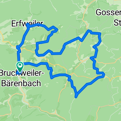
Napoleonfels-Tour Bruchweiler-Bärenbach
A cycling route starting in Bruchweiler-Bärenbach, Rhineland-Palatinate, Germany.
Overview
About this route
TEASI Track
- -:--
- Duration
- 12.7 km
- Distance
- 357 m
- Ascent
- 359 m
- Descent
- ---
- Avg. speed
- ---
- Max. altitude
Route quality
Waytypes & surfaces along the route
Waytypes
Track
9.3 km
(73 %)
Quiet road
2.3 km
(18 %)
Surfaces
Paved
5.6 km
(44 %)
Unpaved
6.1 km
(48 %)
Asphalt
5.1 km
(40 %)
Ground
3.6 km
(28 %)
Route highlights
Points of interest along the route
Point of interest after 0.2 km
Bahnhof Bruchweiler-Bärenbach
Point of interest after 12.4 km
Spießweiher
Continue with Bikemap
Use, edit, or download this cycling route
You would like to ride Napoleonfels-Tour Bruchweiler-Bärenbach or customize it for your own trip? Here is what you can do with this Bikemap route:
Free features
- Save this route as favorite or in collections
- Copy & plan your own version of this route
- Sync your route with Garmin or Wahoo
Premium features
Free trial for 3 days, or one-time payment. More about Bikemap Premium.
- Navigate this route on iOS & Android
- Export a GPX / KML file of this route
- Create your custom printout (try it for free)
- Download this route for offline navigation
Discover more Premium features.
Get Bikemap PremiumFrom our community
Other popular routes starting in Bruchweiler-Bärenbach
 Bad Bergzabern Rundweg
- Distance
- 49.5 km
- Ascent
- 453 m
- Descent
- 473 m
- Location
- Bruchweiler-Bärenbach, Rhineland-Palatinate, Germany
 GPS_2023-08-10_081657 - Dahnrunde
- Distance
- 57.6 km
- Ascent
- 1,621 m
- Descent
- 1,518 m
- Location
- Bruchweiler-Bärenbach, Rhineland-Palatinate, Germany
 Bruchweiler 37Km 531m
- Distance
- 37.2 km
- Ascent
- 529 m
- Descent
- 528 m
- Location
- Bruchweiler-Bärenbach, Rhineland-Palatinate, Germany
 Talstraße 33, Bruchweiler-Bärenbach nach Boulevard Clemenceau 4, Wissembourg
- Distance
- 127.3 km
- Ascent
- 62 m
- Descent
- 103 m
- Location
- Bruchweiler-Bärenbach, Rhineland-Palatinate, Germany
 Napoleonfels-Tour Bruchweiler-Bärenbach
- Distance
- 12.7 km
- Ascent
- 357 m
- Descent
- 359 m
- Location
- Bruchweiler-Bärenbach, Rhineland-Palatinate, Germany
 Dahnrunde_2023
- Distance
- 38.8 km
- Ascent
- 991 m
- Descent
- 991 m
- Location
- Bruchweiler-Bärenbach, Rhineland-Palatinate, Germany
 Frankreichroute ab Bärenbach
- Distance
- 53.1 km
- Ascent
- 443 m
- Descent
- 442 m
- Location
- Bruchweiler-Bärenbach, Rhineland-Palatinate, Germany
 Bruchweiler-Bärenbach nach Erlenbach
- Distance
- 17.4 km
- Ascent
- 221 m
- Descent
- 224 m
- Location
- Bruchweiler-Bärenbach, Rhineland-Palatinate, Germany
Open it in the app