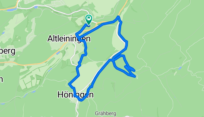
17-MRZ-12
A cycling route starting in Altleiningen, Rhineland-Palatinate, Germany.
Overview
About this route
TEASI track
- -:--
- Duration
- 11.8 km
- Distance
- 354 m
- Ascent
- 351 m
- Descent
- ---
- Avg. speed
- ---
- Avg. speed
Route highlights
Points of interest along the route
Point of interest after 4 km
17-MRZ-12 10:34:54
Point of interest after 5 km
17-MRZ-12 10:50:55
Point of interest after 5.2 km
17-MRZ-12 10:54:31
Point of interest after 11.2 km
17-MRZ-12 9:45:06
Continue with Bikemap
Use, edit, or download this cycling route
You would like to ride 17-MRZ-12 or customize it for your own trip? Here is what you can do with this Bikemap route:
Free features
- Save this route as favorite or in collections
- Copy & plan your own version of this route
- Sync your route with Garmin or Wahoo
Premium features
Free trial for 3 days, or one-time payment. More about Bikemap Premium.
- Navigate this route on iOS & Android
- Export a GPX / KML file of this route
- Create your custom printout (try it for free)
- Download this route for offline navigation
Discover more Premium features.
Get Bikemap PremiumFrom our community
Other popular routes starting in Altleiningen
- Altleiningen-Speyer
- Distance
- 100 km
- Ascent
- 275 m
- Descent
- 273 m
- Location
- Altleiningen, Rhineland-Palatinate, Germany
- Altleiningen
- Distance
- 57.5 km
- Ascent
- 772 m
- Descent
- 772 m
- Location
- Altleiningen, Rhineland-Palatinate, Germany
- 17-MRZ-12
- Distance
- 11.8 km
- Ascent
- 354 m
- Descent
- 351 m
- Location
- Altleiningen, Rhineland-Palatinate, Germany
- Kleine Altleiningen MTB Rundtour
- Distance
- 13.8 km
- Ascent
- 398 m
- Descent
- 397 m
- Location
- Altleiningen, Rhineland-Palatinate, Germany
- Ungeheuersee
- Distance
- 27.5 km
- Ascent
- 473 m
- Descent
- 433 m
- Location
- Altleiningen, Rhineland-Palatinate, Germany
- 2016 Summer Bike Tour
- Distance
- 2,924.6 km
- Ascent
- 4,955 m
- Descent
- 4,983 m
- Location
- Altleiningen, Rhineland-Palatinate, Germany
- Pfalztour Tag 2 abgekürzt
- Distance
- 19.9 km
- Ascent
- 209 m
- Descent
- 232 m
- Location
- Altleiningen, Rhineland-Palatinate, Germany
- Von Gummersbach zum Bodensee Tag 4
- Distance
- 120.8 km
- Ascent
- 543 m
- Descent
- 636 m
- Location
- Altleiningen, Rhineland-Palatinate, Germany
Open it in the app