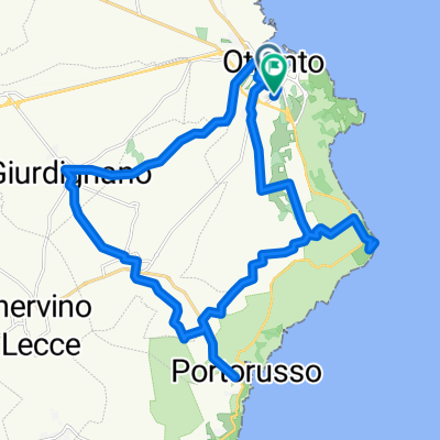
- 32.5 km
- 210 m
- 211 m
- Otranto, Apulia, Italy
3° GIORNO DEL SALENTO
A cycling route starting in Otranto, Apulia, Italy.
Overview
About this route
In this stage we will face the lower Salento, a magical place for beaches and crystal-clear waters.
Land of ancient olive trees, of which the underground oil mills testify. Inside, you can still admire the large stone millstones, once powered by man or a mule, the numerous presses for squeezing, the tanks for decantation and collection.
Route: easy
Travel time: about 4h
Kilometers traveled: about 55 km
Elevation: max 105m
Points of interest: Santa Cesarea/ Tricase/ Specchia
Santa Cesarea:
Latitude: 40°02′09″ N Longitude: 18°27′19″ E Elevation above sea level: 34 m Santa Cesàrea Terme (Santa Cisaria in Salento dialect, until 1929 called Santa Cesarea) is an Italian municipality of 3,027 inhabitants from the province of Lecce in Apulia.
Located on the eastern coast of the Salento peninsula, at the entrance to the Otranto Canal, it is one of the most tourist-oriented centers of Salento. It is a hydrothermal station.
Tricase
Latitude: 39°55′48″ N Longitude: 18°21′15″ E Elevation above sea level: 103 m Tricase is an Italian municipality of 17,737 inhabitants from the province of Lecce in Apulia.
Located in Capo di Leuca, 53.4 km from the provincial capital, it includes a stretch of the eastern coast of lower Salento. It is part of the Intermunicipal Consortium Capo Santa Maria di Leuca, affiliated with the club of authentic villages of Italy. Part of its territory falls within the Costa Otranto - Santa Maria di Leuca Regional Natural Park and the Forest of Tricase.
Specchia:
Latitude: 39°56′20″ N Longitude: 18°17′52″ E Elevation above sea level: 137 m Specchia (until 1873 called Specchia De' Preti) is an Italian municipality of 4,915 inhabitants from the province of Lecce in Apulia.
Located in lower Salento, 53 km from the provincial capital, it is part of the club The Most Beautiful Villages in Italy.
In 2013 it received the recognition as "Jewel of Italy". In 2007, the municipality was recognized as the best emerging rural destination in Italy in the Eden Project.
- -:--
- Duration
- 51.2 km
- Distance
- 396 m
- Ascent
- 339 m
- Descent
- ---
- Avg. speed
- ---
- Max. altitude
created this 10 years ago
Continue with Bikemap
Use, edit, or download this cycling route
You would like to ride 3° GIORNO DEL SALENTO or customize it for your own trip? Here is what you can do with this Bikemap route:
Free features
- Save this route as favorite or in collections
- Copy & plan your own version of this route
- Sync your route with Garmin or Wahoo
Premium features
Free trial for 3 days, or one-time payment. More about Bikemap Premium.
- Navigate this route on iOS & Android
- Export a GPX / KML file of this route
- Create your custom printout (try it for free)
- Download this route for offline navigation
Discover more Premium features.
Get Bikemap PremiumFrom our community
Other popular routes starting in Otranto
- otranto bauxit leuchtturm
- Via Martire Canonico Schito, Otranto to Via Salvatore Trinchese, Lecce
- 45.9 km
- 151 m
- 125 m
- Otranto, Apulia, Italy
- Tappa 2 Otranto SM Leuca
- 56.6 km
- 486 m
- 458 m
- Otranto, Apulia, Italy
- Otranto Lecce
- 47.7 km
- 98 m
- 60 m
- Otranto, Apulia, Italy
- Day Eight
- 47.6 km
- 101 m
- 67 m
- Otranto, Apulia, Italy
- Otranto - Corsano
- 47.4 km
- 425 m
- 307 m
- Otranto, Apulia, Italy
- Otranto - Montesardo
- 63.6 km
- 966 m
- 841 m
- Otranto, Apulia, Italy
- otranto 1
- 33.9 km
- 255 m
- 255 m
- Otranto, Apulia, Italy
Open it in the app


