

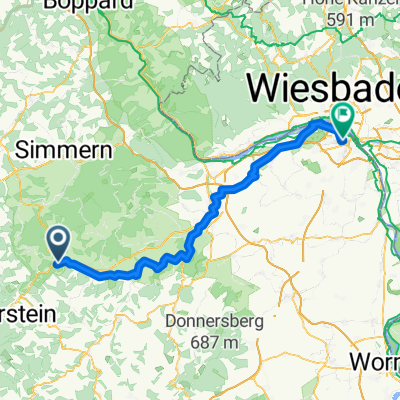
Naheradweg Hochstetten bis Schloßböckelheim und zurück
A cycling route starting in Hochstetten-Dhaun, Rhineland-Palatinate, Germany.
Overview
About this route
visually very beautiful route, relaxed cycling, great nature, nice venues (cloned from route 2778566)
- -:--
- Duration
- 42.2 km
- Distance
- 201 m
- Ascent
- 202 m
- Descent
- ---
- Avg. speed
- ---
- Max. altitude
Route quality
Waytypes & surfaces along the route
Waytypes
Track
18.6 km
(44 %)
Access road
6.8 km
(16 %)
Surfaces
Paved
38 km
(90 %)
Unpaved
0.4 km
(1 %)
Asphalt
33.4 km
(79 %)
Paved (undefined)
4.6 km
(11 %)
Continue with Bikemap
Use, edit, or download this cycling route
You would like to ride Naheradweg Hochstetten bis Schloßböckelheim und zurück or customize it for your own trip? Here is what you can do with this Bikemap route:
Free features
- Save this route as favorite or in collections
- Copy & plan your own version of this route
- Sync your route with Garmin or Wahoo
Premium features
Free trial for 3 days, or one-time payment. More about Bikemap Premium.
- Navigate this route on iOS & Android
- Export a GPX / KML file of this route
- Create your custom printout (try it for free)
- Download this route for offline navigation
Discover more Premium features.
Get Bikemap PremiumFrom our community
Other popular routes starting in Hochstetten-Dhaun
 20170802 Naherunde
- Distance
- 83.3 km
- Ascent
- 365 m
- Descent
- 444 m
- Location
- Hochstetten-Dhaun, Rhineland-Palatinate, Germany
 Bahnhofstraße 2a, Hochstetten-Dhaun nach Auf Neuwiese 17, Fischbach
- Distance
- 15.1 km
- Ascent
- 274 m
- Descent
- 203 m
- Location
- Hochstetten-Dhaun, Rhineland-Palatinate, Germany
 Moseltour 120km von Hochstetten-Dhaun
- Distance
- 120.6 km
- Ascent
- 1,030 m
- Descent
- 1,008 m
- Location
- Hochstetten-Dhaun, Rhineland-Palatinate, Germany
 Industriegebiet 5, Hochstetten-Dhaun nach Industriegebiet 3, Hochstetten-Dhaun
- Distance
- 36.2 km
- Ascent
- 348 m
- Descent
- 347 m
- Location
- Hochstetten-Dhaun, Rhineland-Palatinate, Germany
 Hochstetten Trier on planned radweg
- Distance
- 130.2 km
- Ascent
- 724 m
- Descent
- 788 m
- Location
- Hochstetten-Dhaun, Rhineland-Palatinate, Germany
 Naheradweg Hochstetten bis Schloßböckelheim und zurück
- Distance
- 42.2 km
- Ascent
- 201 m
- Descent
- 202 m
- Location
- Hochstetten-Dhaun, Rhineland-Palatinate, Germany
 Bahnhofstraße 18A, Hochstetten-Dhaun nach Im Hahn 7, Hochstetten-Dhaun
- Distance
- 3.7 km
- Ascent
- 242 m
- Descent
- 89 m
- Location
- Hochstetten-Dhaun, Rhineland-Palatinate, Germany

Fr920Xt®
Hochstetten-Dhaun Radfahren- Distance
- 21.4 km
- Ascent
- 680 m
- Descent
- 672 m
- Location
- Hochstetten-Dhaun, Rhineland-Palatinate, Germany
Open it in the app