

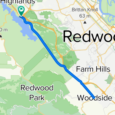
Recording from November 12, 3:39 PM
A cycling route starting in Highlands-Baywood Park, California, United States.
Overview
About this route
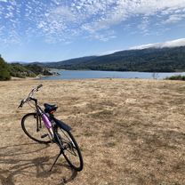
hillside up hill
- 20 min
- Duration
- 3.2 km
- Distance
- 30 m
- Ascent
- 133 m
- Descent
- 9.5 km/h
- Avg. speed
- ---
- Max. altitude

Continue with Bikemap
Use, edit, or download this cycling route
You would like to ride Recording from November 12, 3:39 PM or customize it for your own trip? Here is what you can do with this Bikemap route:
Free features
- Save this route as favorite or in collections
- Copy & plan your own version of this route
- Sync your route with Garmin or Wahoo
Premium features
Free trial for 3 days, or one-time payment. More about Bikemap Premium.
- Navigate this route on iOS & Android
- Export a GPX / KML file of this route
- Create your custom printout (try it for free)
- Download this route for offline navigation
Discover more Premium features.
Get Bikemap PremiumFrom our community
Other popular routes starting in Highlands-Baywood Park
 Canada-Alpine-Page Mill loop
- Distance
- 93.1 km
- Ascent
- 2,193 m
- Descent
- 2,169 m
- Location
- Highlands-Baywood Park, California, United States
 Belmont Woods Way, Belmont to Belmont Woods Way, Belmont
- Distance
- 19 km
- Ascent
- 515 m
- Descent
- 514 m
- Location
- Highlands-Baywood Park, California, United States
 Can#ada up La Honda
- Distance
- 45 km
- Ascent
- 628 m
- Descent
- 639 m
- Location
- Highlands-Baywood Park, California, United States
 Canada to woodside
- Distance
- 23.4 km
- Ascent
- 193 m
- Descent
- 189 m
- Location
- Highlands-Baywood Park, California, United States
 Canada Loop - bike path first
- Distance
- 26.1 km
- Ascent
- 350 m
- Descent
- 350 m
- Location
- Highlands-Baywood Park, California, United States
 36–40 Canada Rd, Redwood City to 2 Mount Vernon Ln, Atherton
- Distance
- 19.4 km
- Ascent
- 139 m
- Descent
- 222 m
- Location
- Highlands-Baywood Park, California, United States
 Belmont Woods Way, Belmont to Belmont Woods Way, Belmont
- Distance
- 12.7 km
- Ascent
- 279 m
- Descent
- 274 m
- Location
- Highlands-Baywood Park, California, United States
 Peninsula.1
- Distance
- 100.5 km
- Ascent
- 2,861 m
- Descent
- 2,852 m
- Location
- Highlands-Baywood Park, California, United States
Open it in the app