

Högl Runde
A cycling route starting in Bergheim, Salzburg, Austria.
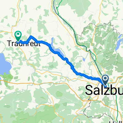
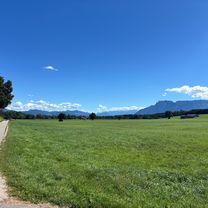
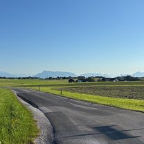
Overview
About this route
Sehr flowig und schnell zu fahren, teils steile Passagen und hohe sprünge
Beste Auffahrt 52 Min Beste Abfahrt 9min 40sec.- -:--
- Duration
- 21.4 km
- Distance
- 382 m
- Ascent
- 380 m
- Descent
- ---
- Avg. speed
- ---
- Max. altitude
Route highlights
Points of interest along the route
Point of interest after 13.6 km
Start Zeitmessung
Point of interest after 13.9 km
Stufe, (ca. 1m) dann bis zum nächsten Forstweg schnelle steile Wurzelpassage mit mehreren kleinen gewachsenen Sprüngen.
Point of interest after 14.4 km
Angelegter Sprung
Point of interest after 14.5 km
Angelegter Sprung
Point of interest after 14.6 km
Angelegter Sprung
Point of interest after 14.6 km
Großer, künstlich angelegter Sprung ca 1 m Hoch 2m weit. !!Achtung!! wenn, dann links umfahren, rechts ist ein großes Loch im Boden!
Point of interest after 15.1 km
Stufe ca 1,20 rechts in Hohlweg hinein
Point of interest after 16.9 km
Sprung rechts
Point of interest after 17 km
Sprung links
Point of interest after 17 km
Stop Zeitmessung Beste : 9:40
Continue with Bikemap
Use, edit, or download this cycling route
You would like to ride Högl Runde or customize it for your own trip? Here is what you can do with this Bikemap route:
Free features
- Save this route as favorite or in collections
- Copy & plan your own version of this route
- Sync your route with Garmin or Wahoo
Premium features
Free trial for 3 days, or one-time payment. More about Bikemap Premium.
- Navigate this route on iOS & Android
- Export a GPX / KML file of this route
- Create your custom printout (try it for free)
- Download this route for offline navigation
Discover more Premium features.
Get Bikemap PremiumFrom our community
Other popular routes starting in Bergheim
 Tour_Högl
- Distance
- 41.4 km
- Ascent
- 632 m
- Descent
- 630 m
- Location
- Bergheim, Salzburg, Austria
 Kaiserbuche_Salzburg
- Distance
- 42.6 km
- Ascent
- 396 m
- Descent
- 394 m
- Location
- Bergheim, Salzburg, Austria
 Kapellenweg, Salzburg nach Austraße, Traunreut
- Distance
- 47.6 km
- Ascent
- 545 m
- Descent
- 445 m
- Location
- Bergheim, Salzburg, Austria
 salzburg nach wendeburg v2
- Distance
- 703.3 km
- Ascent
- 2,457 m
- Descent
- 2,806 m
- Location
- Bergheim, Salzburg, Austria
 Salzburg | rund um den Waginger See
- Distance
- 83.2 km
- Ascent
- 556 m
- Descent
- 553 m
- Location
- Bergheim, Salzburg, Austria
 Salzburg | rund um den Wallersee
- Distance
- 63.1 km
- Ascent
- 651 m
- Descent
- 654 m
- Location
- Bergheim, Salzburg, Austria
 Salzburg | große Wallerseerunde
- Distance
- 71.2 km
- Ascent
- 721 m
- Descent
- 719 m
- Location
- Bergheim, Salzburg, Austria
 Europastraße, Salzburg nach Baderstraße, Bad Reichenhall
- Distance
- 19.4 km
- Ascent
- 260 m
- Descent
- 201 m
- Location
- Bergheim, Salzburg, Austria
Open it in the app