

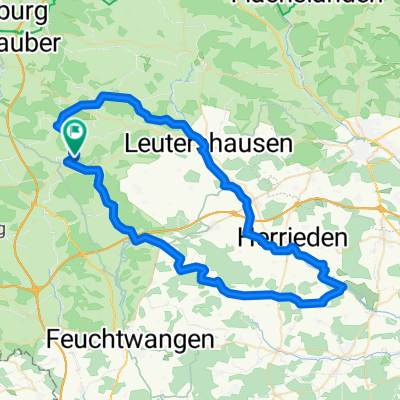
Rundfahrt Altmühltal - Donau - Wörnitz
A cycling route starting in Schillingsfürst, Bavaria, Germany.
Overview
About this route
Along the rivers Altmühl - Danube - Wörnitz 263 km
- -:--
- Duration
- 263.2 km
- Distance
- 168 m
- Ascent
- 172 m
- Descent
- ---
- Avg. speed
- ---
- Max. altitude
Route quality
Waytypes & surfaces along the route
Waytypes
Quiet road
63.2 km
(24 %)
Path
50 km
(19 %)
Surfaces
Paved
186.9 km
(71 %)
Unpaved
10.5 km
(4 %)
Asphalt
176.4 km
(67 %)
Paved (undefined)
10.5 km
(4 %)
Continue with Bikemap
Use, edit, or download this cycling route
You would like to ride Rundfahrt Altmühltal - Donau - Wörnitz or customize it for your own trip? Here is what you can do with this Bikemap route:
Free features
- Save this route as favorite or in collections
- Copy & plan your own version of this route
- Split it into stages to create a multi-day tour
- Sync your route with Garmin or Wahoo
Premium features
Free trial for 3 days, or one-time payment. More about Bikemap Premium.
- Navigate this route on iOS & Android
- Export a GPX / KML file of this route
- Create your custom printout (try it for free)
- Download this route for offline navigation
Discover more Premium features.
Get Bikemap PremiumFrom our community
Other popular routes starting in Schillingsfürst
 Radschmetterling grün 2.
- Distance
- 59.4 km
- Ascent
- 520 m
- Descent
- 520 m
- Location
- Schillingsfürst, Bavaria, Germany
 Rundfahrt Altmühltal - Donau - Wörnitz
- Distance
- 263.2 km
- Ascent
- 168 m
- Descent
- 172 m
- Location
- Schillingsfürst, Bavaria, Germany
 B2-11/B12c: Schillingsfürst - Fremdingen, 66,1km 550hm
- Distance
- 66.1 km
- Ascent
- 671 m
- Descent
- 720 m
- Location
- Schillingsfürst, Bavaria, Germany
 Mittlere Trainingsstrecke
- Distance
- 33.3 km
- Ascent
- 318 m
- Descent
- 312 m
- Location
- Schillingsfürst, Bavaria, Germany
 Schillingsfürst - Herrieden -Schillingsfürst
- Distance
- 66.9 km
- Ascent
- 323 m
- Descent
- 329 m
- Location
- Schillingsfürst, Bavaria, Germany
 Sch --> Nürnberg Aug 2009
- Distance
- 79.4 km
- Ascent
- 377 m
- Descent
- 601 m
- Location
- Schillingsfürst, Bavaria, Germany
 TG04 rot Radschmetterling romantisches Franken
- Distance
- 57.6 km
- Ascent
- 510 m
- Descent
- 508 m
- Location
- Schillingsfürst, Bavaria, Germany
 Woernitzradweg
- Distance
- 106.2 km
- Ascent
- 108 m
- Descent
- 205 m
- Location
- Schillingsfürst, Bavaria, Germany
Open it in the app