

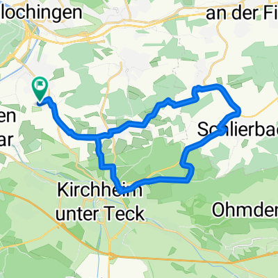
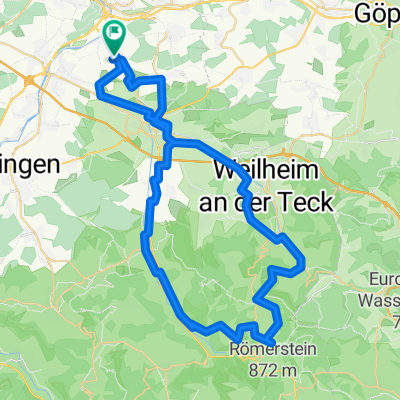
20151115_130946.gpx
A cycling route starting in Wernau, Baden-Wurttemberg, Germany.
Overview
About this route
TEASI track
- -:--
- Duration
- 31.8 km
- Distance
- 352 m
- Ascent
- 352 m
- Descent
- ---
- Avg. speed
- ---
- Max. altitude

Route quality
Waytypes & surfaces along the route
Waytypes
Track
17.8 km
(56 %)
Quiet road
6.7 km
(21 %)
Surfaces
Paved
15.3 km
(48 %)
Unpaved
11.4 km
(36 %)
Asphalt
10.2 km
(32 %)
Gravel
6 km
(19 %)
Continue with Bikemap
Use, edit, or download this cycling route
You would like to ride 20151115_130946.gpx or customize it for your own trip? Here is what you can do with this Bikemap route:
Free features
- Save this route as favorite or in collections
- Copy & plan your own version of this route
- Sync your route with Garmin or Wahoo
Premium features
Free trial for 3 days, or one-time payment. More about Bikemap Premium.
- Navigate this route on iOS & Android
- Export a GPX / KML file of this route
- Create your custom printout (try it for free)
- Download this route for offline navigation
Discover more Premium features.
Get Bikemap PremiumFrom our community
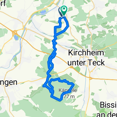
Other popular routes starting in Wernau
 Finkenstraße 52, Wernau (Neckar) nach Finkenstraße 54, Wernau (Neckar)
- Distance
- 21.6 km
- Ascent
- 239 m
- Descent
- 237 m
- Location
- Wernau, Baden-Wurttemberg, Germany
 E-Bike_Abendtour
- Distance
- 23.2 km
- Ascent
- 365 m
- Descent
- 365 m
- Location
- Wernau, Baden-Wurttemberg, Germany
 Otto-Hahn-Straße, Wernau nach Otto-Hahn-Straße, Wernau
- Distance
- 27.7 km
- Ascent
- 273 m
- Descent
- 278 m
- Location
- Wernau, Baden-Wurttemberg, Germany
 Otto-Hahn-Straße, Wernau nach Otto-Hahn-Straße, Wernau
- Distance
- 42.1 km
- Ascent
- 670 m
- Descent
- 670 m
- Location
- Wernau, Baden-Wurttemberg, Germany
 Feierabendrunde
- Distance
- 5.9 km
- Ascent
- 66 m
- Descent
- 69 m
- Location
- Wernau, Baden-Wurttemberg, Germany
 Bikemap Wernau Sielmingen
- Distance
- 16.8 km
- Ascent
- 202 m
- Descent
- 119 m
- Location
- Wernau, Baden-Wurttemberg, Germany
 E-Bike-Harprechtshaus-Rundtour_63 km
- Distance
- 62.8 km
- Ascent
- 1,136 m
- Descent
- 1,142 m
- Location
- Wernau, Baden-Wurttemberg, Germany
 Rundfahrt
- Distance
- 29.3 km
- Ascent
- 431 m
- Descent
- 447 m
- Location
- Wernau, Baden-Wurttemberg, Germany
Open it in the app