

2TT/2016 Bad Säckingen - Bern
A cycling route starting in Stein, Canton of Aargau, Switzerland.
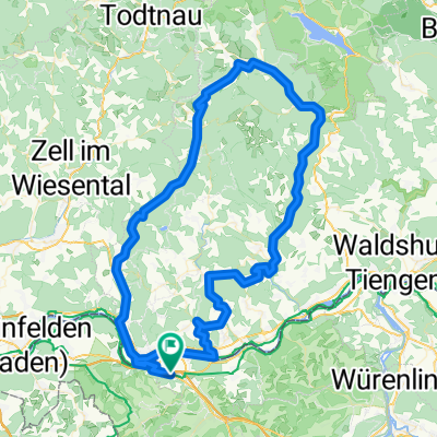
Overview
About this route
Bad Säckingen (Münsterplatz) - Frick - Benkenjoch - Erlinsbach - Trimbach - Olten - Boningen - Wolfwil - Break at Restaurant Fähre - Schwarzhäusern - Heimenhausen - 34 Bike Path over Kirchberg to Zollikofen - Worblaufen - Länggass - Güterbahnhof - Seftigenstrasse
- -:--
- Duration
- 114 km
- Distance
- 860 m
- Ascent
- 605 m
- Descent
- ---
- Avg. speed
- ---
- Max. altitude

Route quality
Waytypes & surfaces along the route
Waytypes
Quiet road
52.4 km
(46 %)
Road
46.7 km
(41 %)
Surfaces
Paved
86.6 km
(76 %)
Asphalt
84.4 km
(74 %)
Paved (undefined)
1.1 km
(1 %)
Route highlights
Points of interest along the route
Point of interest after 53.8 km
Pause Restaurant Fähre
Continue with Bikemap
Use, edit, or download this cycling route
You would like to ride 2TT/2016 Bad Säckingen - Bern or customize it for your own trip? Here is what you can do with this Bikemap route:
Free features
- Save this route as favorite or in collections
- Copy & plan your own version of this route
- Split it into stages to create a multi-day tour
- Sync your route with Garmin or Wahoo
Premium features
Free trial for 3 days, or one-time payment. More about Bikemap Premium.
- Navigate this route on iOS & Android
- Export a GPX / KML file of this route
- Create your custom printout (try it for free)
- Download this route for offline navigation
Discover more Premium features.
Get Bikemap PremiumFrom our community
Other popular routes starting in Stein
 Erste Tour von Wehr nach Laufenburg
- Distance
- 32.9 km
- Ascent
- 503 m
- Descent
- 479 m
- Location
- Stein, Canton of Aargau, Switzerland
 Fisibach-Schneisingen-Gansingen
- Distance
- 106.8 km
- Ascent
- 687 m
- Descent
- 687 m
- Location
- Stein, Canton of Aargau, Switzerland
 Murgtaltour
- Distance
- 26.2 km
- Ascent
- 654 m
- Descent
- 599 m
- Location
- Stein, Canton of Aargau, Switzerland
 2TT/2016 Bad Säckingen - Bern
- Distance
- 114 km
- Ascent
- 860 m
- Descent
- 605 m
- Location
- Stein, Canton of Aargau, Switzerland
 Rhein - Aare - Fahrradtour
- Distance
- 86.3 km
- Ascent
- 524 m
- Descent
- 523 m
- Location
- Stein, Canton of Aargau, Switzerland
 Gippingen - Albruck - Hottingen - Hornberg - Bergalingen
- Distance
- 99.7 km
- Ascent
- 1,056 m
- Descent
- 1,056 m
- Location
- Stein, Canton of Aargau, Switzerland
 Gippingen - Buch - Niederwihl
- Distance
- 80.1 km
- Ascent
- 779 m
- Descent
- 780 m
- Location
- Stein, Canton of Aargau, Switzerland
 Wehr - Todtmoos - Bernau - Tiefenstein - Oberwihl - Murg
- Distance
- 109.1 km
- Ascent
- 1,179 m
- Descent
- 1,179 m
- Location
- Stein, Canton of Aargau, Switzerland
Open it in the app