

Columbus_Xenia_OTE
A cycling route starting in Columbus, Ohio, United States.
Overview
About this route
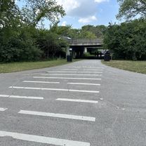
Columbus to Xenia via Ohio to Erie bike path
- -:--
- Duration
- 92.8 km
- Distance
- 196 m
- Ascent
- 132 m
- Descent
- ---
- Avg. speed
- ---
- Max. altitude

Route quality
Waytypes & surfaces along the route
Waytypes
Cycleway
44.2 km
(48 %)
Quiet road
12.4 km
(13 %)
Surfaces
Paved
46.3 km
(50 %)
Paved (undefined)
24.9 km
(27 %)
Asphalt
21.4 km
(23 %)
Undefined
46.5 km
(50 %)
Continue with Bikemap
Use, edit, or download this cycling route
You would like to ride Columbus_Xenia_OTE or customize it for your own trip? Here is what you can do with this Bikemap route:
Free features
- Save this route as favorite or in collections
- Copy & plan your own version of this route
- Split it into stages to create a multi-day tour
- Sync your route with Garmin or Wahoo
Premium features
Free trial for 3 days, or one-time payment. More about Bikemap Premium.
- Navigate this route on iOS & Android
- Export a GPX / KML file of this route
- Create your custom printout (try it for free)
- Download this route for offline navigation
Discover more Premium features.
Get Bikemap PremiumFrom our community
Other popular routes starting in Columbus
 Dowtown Stroll to Courthouse and Scioto
- Distance
- 13.1 km
- Ascent
- 58 m
- Descent
- 56 m
- Location
- Columbus, Ohio, United States
 102 W Broad St, Columbus to 6 N Washington St, Millersburg
- Distance
- 148.3 km
- Ascent
- 774 m
- Descent
- 724 m
- Location
- Columbus, Ohio, United States
 Columbus_Xenia_OTE
- Distance
- 92.8 km
- Ascent
- 196 m
- Descent
- 132 m
- Location
- Columbus, Ohio, United States
 Olentangy trail
- Distance
- 21.6 km
- Ascent
- 73 m
- Descent
- 63 m
- Location
- Columbus, Ohio, United States
 200–298 Daniel Burnham Square, Columbus to 244 Daniel Burnham Square, Columbus
- Distance
- 18.3 km
- Ascent
- 93 m
- Descent
- 94 m
- Location
- Columbus, Ohio, United States
 Schumacher Place
- Distance
- 6.5 km
- Ascent
- 336 m
- Descent
- 351 m
- Location
- Columbus, Ohio, United States
 Mills Park Hotel, Yellow Springs
- Distance
- 88.8 km
- Ascent
- 355 m
- Descent
- 295 m
- Location
- Columbus, Ohio, United States
 around the city
- Distance
- 24.3 km
- Ascent
- 72 m
- Descent
- 71 m
- Location
- Columbus, Ohio, United States
Open it in the app