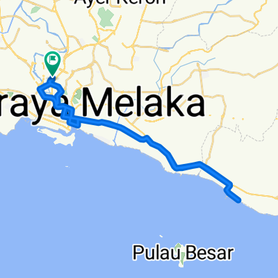
J64 - Melaka - Batu Pahat
A cycling route starting in Malacca, Melaka, Malaysia.
Overview
About this route
J64 - Mercredi 19 mars 2014 - Melaka - Batu Pahat - 105,62 kms - moyenne 15,40 kms / h - dénivelé montant 81 m - pente Maxi 4 %.
(cloned from route 2521139)
- -:--
- Duration
- 104.6 km
- Distance
- 22 m
- Ascent
- 23 m
- Descent
- ---
- Avg. speed
- ---
- Avg. speed
Continue with Bikemap
Use, edit, or download this cycling route
You would like to ride J64 - Melaka - Batu Pahat or customize it for your own trip? Here is what you can do with this Bikemap route:
Free features
- Save this route as favorite or in collections
- Copy & plan your own version of this route
- Sync your route with Garmin or Wahoo
Premium features
Free trial for 3 days, or one-time payment. More about Bikemap Premium.
- Navigate this route on iOS & Android
- Export a GPX / KML file of this route
- Create your custom printout (try it for free)
- Download this route for offline navigation
Discover more Premium features.
Get Bikemap PremiumFrom our community
Other popular routes starting in Malacca
- melaka ride
- Distance
- 17.4 km
- Ascent
- 9 m
- Descent
- 3 m
- Location
- Malacca, Melaka, Malaysia
- Melaka to Nusujaya
- Distance
- 211.5 km
- Ascent
- 111 m
- Descent
- 89 m
- Location
- Malacca, Melaka, Malaysia
- Melaka - Puj
- Distance
- 138.1 km
- Ascent
- 309 m
- Descent
- 290 m
- Location
- Malacca, Melaka, Malaysia
- Malacca - AVANI Sepang Gold Coast Resort
- Distance
- 117.6 km
- Ascent
- 163 m
- Descent
- 164 m
- Location
- Malacca, Melaka, Malaysia
- Route from Jalan Tun Perak, Malacca
- Distance
- 45 km
- Ascent
- 3 m
- Descent
- 6 m
- Location
- Malacca, Melaka, Malaysia
- MELAKA COFFEE RIVER RIDE
- Distance
- 9.8 km
- Ascent
- 36 m
- Descent
- 36 m
- Location
- Malacca, Melaka, Malaysia
- 35> km
- Distance
- 37.8 km
- Ascent
- 70 m
- Descent
- 71 m
- Location
- Malacca, Melaka, Malaysia
- Bandar Melaka
- Distance
- 12.2 km
- Ascent
- 25 m
- Descent
- 22 m
- Location
- Malacca, Melaka, Malaysia
Open it in the app