

20150301_093632.gpx
A cycling route starting in Nesselwängle, Tyrol, Austria.
Overview
About this route
TEASI track
- -:--
- Duration
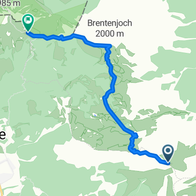
- 3.4 km
- Distance
- 827 m
- Ascent
- 8 m
- Descent
- ---
- Avg. speed
- ---
- Max. altitude
Continue with Bikemap
Use, edit, or download this cycling route
You would like to ride 20150301_093632.gpx or customize it for your own trip? Here is what you can do with this Bikemap route:
Free features
- Save this route as favorite or in collections
- Copy & plan your own version of this route
- Sync your route with Garmin or Wahoo
Premium features
Free trial for 3 days, or one-time payment. More about Bikemap Premium.
- Navigate this route on iOS & Android
- Export a GPX / KML file of this route
- Create your custom printout (try it for free)
- Download this route for offline navigation
Discover more Premium features.
Get Bikemap PremiumFrom our community
Other popular routes starting in Nesselwängle
 Krinnenspitze
- Distance
- 9 km
- Ascent
- 851 m
- Descent
- 847 m
- Location
- Nesselwängle, Tyrol, Austria
 krottental
- Distance
- 18.9 km
- Ascent
- 353 m
- Descent
- 743 m
- Location
- Nesselwängle, Tyrol, Austria
 Enziansteig-Krinnenspitze
- Distance
- 16.8 km
- Ascent
- 1,004 m
- Descent
- 1,004 m
- Location
- Nesselwängle, Tyrol, Austria
 Memmingen-Nesselwängle
- Distance
- 95.1 km
- Ascent
- 458 m
- Descent
- 937 m
- Location
- Nesselwängle, Tyrol, Austria
 Namlos-Runde_ST
- Distance
- 66.1 km
- Ascent
- 938 m
- Descent
- 932 m
- Location
- Nesselwängle, Tyrol, Austria
 Aitrach - Nesselwängle
- Distance
- 95 km
- Ascent
- 809 m
- Descent
- 1,352 m
- Location
- Nesselwängle, Tyrol, Austria
 Seeenrunde
- Distance
- 27.7 km
- Ascent
- 327 m
- Descent
- 327 m
- Location
- Nesselwängle, Tyrol, Austria
 Füssner Röchle - Brentnerjoch - Bad Kissinger Hütte
- Distance
- 5.1 km
- Ascent
- 505 m
- Descent
- 537 m
- Location
- Nesselwängle, Tyrol, Austria
Open it in the app