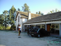
La Resinera - Puerto Frigiliana
A cycling route starting in Arenas del Rey, Andalusia, Spain.
Overview
About this route
A not very demanding route in the northeast area of Sierra Almijara. The route alternates between the different valleys descending from Sierra Almijara towards the Genil basin, passes through some charming spots like Casas de Monticara or the Salar de la Encina, and finishes by descending the northeast slopes of Cerro del Lucero.
- -:--
- Duration
- 38.1 km
- Distance
- 1,262 m
- Ascent
- 1,076 m
- Descent
- ---
- Avg. speed
- 1,389 m
- Max. altitude
Route quality
Waytypes & surfaces along the route
Waytypes
Track
36.2 km
(95 %)
Quiet road
0.8 km
(2 %)
Surfaces
Paved
9.9 km
(26 %)
Unpaved
24 km
(63 %)
Gravel
21 km
(55 %)
Paved (undefined)
8.8 km
(23 %)
Route highlights
Points of interest along the route

Point of interest after 0 km
La resinera

Point of interest after 10.1 km
Mirador Haza de la Encina

Point of interest after 10.4 km
Vistas del Lucero y La Chapa

Point of interest after 15 km
Point of interest after 17.2 km
Cortijo de Cabañeros

Point of interest after 22.6 km
Casas de Monticara

Point of interest after 24.3 km
Vistas de Sierra Almijara

Point of interest after 29.8 km
Cruce Puerto de Frigiliana
Continue with Bikemap
Use, edit, or download this cycling route
You would like to ride La Resinera - Puerto Frigiliana or customize it for your own trip? Here is what you can do with this Bikemap route:
Free features
- Save this route as favorite or in collections
- Copy & plan your own version of this route
- Sync your route with Garmin or Wahoo
Premium features
Free trial for 3 days, or one-time payment. More about Bikemap Premium.
- Navigate this route on iOS & Android
- Export a GPX / KML file of this route
- Create your custom printout (try it for free)
- Download this route for offline navigation
Discover more Premium features.
Get Bikemap PremiumFrom our community
Other popular routes starting in Arenas del Rey
 Sierra Almijara
- Distance
- 63.9 km
- Ascent
- 1,416 m
- Descent
- 1,416 m
- Location
- Arenas del Rey, Andalusia, Spain
 Resinera 37km
- Distance
- 36.6 km
- Ascent
- 853 m
- Descent
- 855 m
- Location
- Arenas del Rey, Andalusia, Spain
 Circular Játar (Sierra Tejeda)
- Distance
- 50.6 km
- Ascent
- 1,099 m
- Descent
- 1,183 m
- Location
- Arenas del Rey, Andalusia, Spain
 Hiszpania 2
- Distance
- 60.5 km
- Ascent
- 1,140 m
- Descent
- 606 m
- Location
- Arenas del Rey, Andalusia, Spain
 RESINERA - PISTA DE ATERRIZAJE INFOCA
- Distance
- 18.9 km
- Ascent
- 329 m
- Descent
- 329 m
- Location
- Arenas del Rey, Andalusia, Spain
 LAS PILILLAS, por el embalse de los Bermejales
- Distance
- 5.1 km
- Ascent
- 314 m
- Descent
- 25 m
- Location
- Arenas del Rey, Andalusia, Spain
 La Resinera - Mesa de Fornes
- Distance
- 18.8 km
- Ascent
- 353 m
- Descent
- 358 m
- Location
- Arenas del Rey, Andalusia, Spain
 Circular en La Resinera
- Distance
- 40 km
- Ascent
- 856 m
- Descent
- 860 m
- Location
- Arenas del Rey, Andalusia, Spain
Open it in the app


