

Girolibero: Scozia e il canale di Caledonia
A cycling route starting in Oban, Scotland, United Kingdom.
Overview
About this route
Pernottamenti: Oban, Craignure, Salen, Lochaline, Fort William
Navigazione: Oban-Craignure, Salen-Lochaline, Corran-Fort William Punto d'interesse: Tobermory, Lochbuie, Corran, Lago Loch Lochy- -:--
- Duration
- 397 km
- Distance
- 943 m
- Ascent
- 947 m
- Descent
- ---
- Avg. speed
- ---
- Max. altitude

Route highlights
Points of interest along the route
Photo after 39.9 km
Lochbuie
Accommodation after 122.6 km
Salen
Photo after 177.6 km
Tobermory
Accommodation after 206.1 km
Lochaline
Drinking water after 262.6 km
Lago Loch Eil
Drinking water after 273.8 km
Lago Loch Arkaig
Point of interest after 301.6 km
Lago Loch Lochy
Drinking water after 313 km
Lago Loch Lochy
Accommodation after 334.7 km
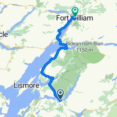
Fort William
Photo after 348.4 km
Corran
Drinking water after 369.6 km
Lago Loch Linnhe
Continue with Bikemap
Use, edit, or download this cycling route
You would like to ride Girolibero: Scozia e il canale di Caledonia or customize it for your own trip? Here is what you can do with this Bikemap route:
Free features
- Save this route as favorite or in collections
- Copy & plan your own version of this route
- Split it into stages to create a multi-day tour
- Sync your route with Garmin or Wahoo
Premium features
Free trial for 3 days, or one-time payment. More about Bikemap Premium.
- Navigate this route on iOS & Android
- Export a GPX / KML file of this route
- Create your custom printout (try it for free)
- Download this route for offline navigation
Discover more Premium features.
Get Bikemap PremiumFrom our community
Other popular routes starting in Oban
 Scotland 2020 Day 07
- Distance
- 34.9 km
- Ascent
- 226 m
- Descent
- 225 m
- Location
- Oban, Scotland, United Kingdom
 Girolibero: Scozia e il canale di Caledonia
- Distance
- 397 km
- Ascent
- 943 m
- Descent
- 947 m
- Location
- Oban, Scotland, United Kingdom
 Bonawe to Fort William
- Distance
- 70 km
- Ascent
- 406 m
- Descent
- 412 m
- Location
- Oban, Scotland, United Kingdom
 oban fort william
- Distance
- 77.4 km
- Ascent
- 264 m
- Descent
- 270 m
- Location
- Oban, Scotland, United Kingdom
 Scotland 2020 Day 08
- Distance
- 53.4 km
- Ascent
- 199 m
- Descent
- 200 m
- Location
- Oban, Scotland, United Kingdom
 Oban Fort William
- Distance
- 80.7 km
- Ascent
- 285 m
- Descent
- 286 m
- Location
- Oban, Scotland, United Kingdom
 Oban 109km route
- Distance
- 109.2 km
- Ascent
- 896 m
- Descent
- 902 m
- Location
- Oban, Scotland, United Kingdom
 St Columba's Way - Taynuilt to Dalmally St Columba's way-Taynuilt to Dalmally
- Distance
- 34.2 km
- Ascent
- 728 m
- Descent
- 706 m
- Location
- Oban, Scotland, United Kingdom
Open it in the app