

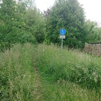
Steyer: Mirower Runde
A cycling route starting in Rechlin, Mecklenburg-Vorpommern, Germany.
Overview
About this route
Loop course while revising my dissertation. (cloned from route 1263631)
- -:--
- Duration
- 64.5 km
- Distance
- 199 m
- Ascent
- 199 m
- Descent
- ---
- Avg. speed
- ---
- Max. altitude
Route quality
Waytypes & surfaces along the route
Waytypes
Road
27.7 km
(43 %)
Path
5.8 km
(9 %)
Surfaces
Paved
42.6 km
(66 %)
Asphalt
41.3 km
(64 %)
Paved (undefined)
1.3 km
(2 %)
Undefined
21.9 km
(34 %)
Continue with Bikemap
Use, edit, or download this cycling route
You would like to ride Steyer: Mirower Runde or customize it for your own trip? Here is what you can do with this Bikemap route:
Free features
- Save this route as favorite or in collections
- Copy & plan your own version of this route
- Sync your route with Garmin or Wahoo
Premium features
Free trial for 3 days, or one-time payment. More about Bikemap Premium.
- Navigate this route on iOS & Android
- Export a GPX / KML file of this route
- Create your custom printout (try it for free)
- Download this route for offline navigation
Discover more Premium features.
Get Bikemap PremiumFrom our community
Other popular routes starting in Rechlin
 Mirow-Neustrelitz-Schwarz-Mirow
- Distance
- 101.6 km
- Ascent
- 430 m
- Descent
- 427 m
- Location
- Rechlin, Mecklenburg-Vorpommern, Germany
 Boeker Mühle rundweg 27km
- Distance
- 26.7 km
- Ascent
- 102 m
- Descent
- 102 m
- Location
- Rechlin, Mecklenburg-Vorpommern, Germany
 Sandberg 1, Wittstock/Dosse nach Bliesendorfer Dorfstraße 23, Werder (Havel)
- Distance
- 148.9 km
- Ascent
- 783 m
- Descent
- 792 m
- Location
- Rechlin, Mecklenburg-Vorpommern, Germany
 Imkerweg, Rechlin nach Mittelstraße, Rechlin
- Distance
- 19.6 km
- Ascent
- 28 m
- Descent
- 28 m
- Location
- Rechlin, Mecklenburg-Vorpommern, Germany
 Mirow Runde mit Kinder Und Badestopps
- Distance
- 40.6 km
- Ascent
- 138 m
- Descent
- 135 m
- Location
- Rechlin, Mecklenburg-Vorpommern, Germany
 Mittelstraße, Rechlin nach Imkerweg, Rechlin
- Distance
- 64.9 km
- Ascent
- 259 m
- Descent
- 259 m
- Location
- Rechlin, Mecklenburg-Vorpommern, Germany
 Fritz-Reuter-Straße, Rechlin nach Markt, Krakow am See
- Distance
- 78.2 km
- Ascent
- 519 m
- Descent
- 534 m
- Location
- Rechlin, Mecklenburg-Vorpommern, Germany
 Müritzrundweg
- Distance
- 91.6 km
- Ascent
- 199 m
- Descent
- 189 m
- Location
- Rechlin, Mecklenburg-Vorpommern, Germany
Open it in the app