

Ried im Traunkreis - Kremsmünster (Ortszentren, Umgehung von Hauptverkehrsstraßen)
A cycling route starting in Sattledt, Upper Austria, Austria.
Overview
About this route
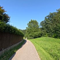
From the municipal office, turn left onto the main road and leave it after a few hundred meters, turning right onto the Helmberg freight road. You can now follow this road without any problems and mostly downhill through Zenndorf and Helmberg for over 4 km. After a steep descent at Kreuzberg, you arrive at Gablonzer Street, which you should follow for about 600 meters, passing under the B122 in the last stretch. Then turn right, cross the main road and the town hall square to reach the village center.
Duration: 10 - 15 minutes- -:--
- Duration
- 5.9 km
- Distance
- 30 m
- Ascent
- 148 m
- Descent
- ---
- Avg. speed
- ---
- Max. altitude
Route quality
Waytypes & surfaces along the route
Waytypes
Quiet road
5.3 km
(89 %)
Pedestrian area
0.1 km
(1 %)
Undefined
0.6 km
(10 %)
Continue with Bikemap
Use, edit, or download this cycling route
You would like to ride Ried im Traunkreis - Kremsmünster (Ortszentren, Umgehung von Hauptverkehrsstraßen) or customize it for your own trip? Here is what you can do with this Bikemap route:
Free features
- Save this route as favorite or in collections
- Copy & plan your own version of this route
- Sync your route with Garmin or Wahoo
Premium features
Free trial for 3 days, or one-time payment. More about Bikemap Premium.
- Navigate this route on iOS & Android
- Export a GPX / KML file of this route
- Create your custom printout (try it for free)
- Download this route for offline navigation
Discover more Premium features.
Get Bikemap PremiumFrom our community
Other popular routes starting in Sattledt
 Ried im Traunkreis - Pettenbach (Ortszentren, Umgehung von Hauptverkehrsstraßen)
- Distance
- 10.9 km
- Ascent
- 131 m
- Descent
- 114 m
- Location
- Sattledt, Upper Austria, Austria
 Fischlham Pizza
- Distance
- 10.4 km
- Ascent
- 90 m
- Descent
- 134 m
- Location
- Sattledt, Upper Austria, Austria
 Schloss Achleiten – die Krems Runde von Sattledt. 🚴♂️🚴
- Distance
- 56.1 km
- Ascent
- 569 m
- Descent
- 568 m
- Location
- Sattledt, Upper Austria, Austria
 Ried im Traunkreis - Wartberg an der Krems (Ortszentren, Umgehung von Hauptverkehrsstraßen)
- Distance
- 6.3 km
- Ascent
- 58 m
- Descent
- 141 m
- Location
- Sattledt, Upper Austria, Austria
 Ried im Traunkreis - Kremsmünster (Ortszentren, Umgehung von Hauptverkehrsstraßen)
- Distance
- 5.9 km
- Ascent
- 30 m
- Descent
- 148 m
- Location
- Sattledt, Upper Austria, Austria
 rus treining
- Distance
- 120.6 km
- Ascent
- 1,832 m
- Descent
- 1,830 m
- Location
- Sattledt, Upper Austria, Austria
 Maria am Wege Kapelle – Blick auf den Traunstein Runde von Sattledt
- Distance
- 69.8 km
- Ascent
- 545 m
- Descent
- 546 m
- Location
- Sattledt, Upper Austria, Austria
 Wk 3 - 1820 to 2780
- Distance
- 964 km
- Ascent
- 1,232 m
- Descent
- 1,534 m
- Location
- Sattledt, Upper Austria, Austria
Open it in the app