Wartberg an der Krems - Pfarrkirchen bei Bad Hall (Ortszentren, Umgehung von Hauptverkehrsstraßen)
A cycling route starting in Kremsmünster, Upper Austria, Austria.
Overview
About this route
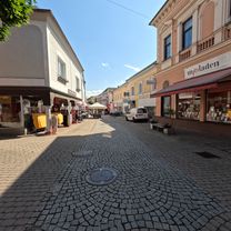
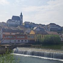
From the church square, you go down the L1330 over the Krems and then pass under the tracks. Then, you turn right onto a bike and pedestrian path that winds out of the center. After a short time, you reach Leinburger Straße, where you turn left and ride uphill for a few meters until you cross the L554, and then continue on Im Lus and later Güterweg Plaschl for the next 3 km almost continuously uphill. After that, you reach Guntendorfer Straße L1334, turn left and follow it for the next 1.2 km, then at the intersection with Wartberger Straße L1330, keep right and follow this country road for the next 5 km until Pfarrkirchen, where shortly after entering the town, the parish and municipal office are located. Duration: 25-30 minutes
- -:--
- Duration
- 9.9 km
- Distance
- 142 m
- Ascent
- 129 m
- Descent
- ---
- Avg. speed
- ---
- Max. altitude
Route quality
Waytypes & surfaces along the route
Waytypes
Road
7.2 km
(73 %)
Quiet road
2.5 km
(25 %)
Continue with Bikemap
Use, edit, or download this cycling route
You would like to ride Wartberg an der Krems - Pfarrkirchen bei Bad Hall (Ortszentren, Umgehung von Hauptverkehrsstraßen) or customize it for your own trip? Here is what you can do with this Bikemap route:
Free features
- Save this route as favorite or in collections
- Copy & plan your own version of this route
- Sync your route with Garmin or Wahoo
Premium features
Free trial for 3 days, or one-time payment. More about Bikemap Premium.
- Navigate this route on iOS & Android
- Export a GPX / KML file of this route
- Create your custom printout (try it for free)
- Download this route for offline navigation
Discover more Premium features.
Get Bikemap PremiumFrom our community
Other popular routes starting in Kremsmünster
- Kremsmünster - Sipbachzell - Sattledt - Kremsmünster
- Distance
- 27.8 km
- Ascent
- 185 m
- Descent
- 218 m
- Location
- Kremsmünster, Upper Austria, Austria
- Krems - Steyrtal
- Distance
- 76.6 km
- Ascent
- 291 m
- Descent
- 294 m
- Location
- Kremsmünster, Upper Austria, Austria
- Sipbachzell - Magdalenaberg
- Distance
- 50.9 km
- Ascent
- 395 m
- Descent
- 395 m
- Location
- Kremsmünster, Upper Austria, Austria
- Kremsmünster - Ansfelden
- Distance
- 24.4 km
- Ascent
- 65 m
- Descent
- 135 m
- Location
- Kremsmünster, Upper Austria, Austria
- Kremsmünster-Sattledt
- Distance
- 11.3 km
- Ascent
- 142 m
- Descent
- 85 m
- Location
- Kremsmünster, Upper Austria, Austria
- Filialkirche Weigersdorf – Krems Runde von Kremsmünster 🚶♀️🚶♂️
- Distance
- 58.9 km
- Ascent
- 1,056 m
- Descent
- 1,057 m
- Location
- Kremsmünster, Upper Austria, Austria
- Krift - Kremstaler Landmatura - schlierbach - wartberg - Krift
- Distance
- 25.3 km
- Ascent
- 119 m
- Descent
- 124 m
- Location
- Kremsmünster, Upper Austria, Austria
- Krift - Scheiben - Feyregg - Diepersdorf - Nußbach - Schlierbach - Wartberg - Krift
- Distance
- 46.5 km
- Ascent
- 826 m
- Descent
- 825 m
- Location
- Kremsmünster, Upper Austria, Austria
Open it in the app