

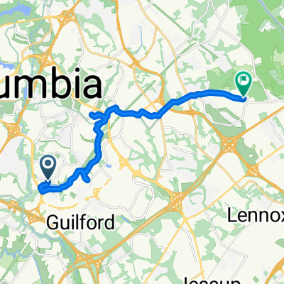
Recording from November 21, 1:55 PM
A cycling route starting in Riverside, Maryland, United States.
Overview
About this route
- 14 min
- Duration
- 2.8 km
- Distance
- 27 m
- Ascent
- 29 m
- Descent
- 11.6 km/h
- Avg. speed
- ---
- Max. altitude
Route quality
Waytypes & surfaces along the route
Waytypes
Road
2 km
(70 %)
Path
0.7 km
(24 %)
Surfaces
Paved
0.7 km
(26 %)
Paved (undefined)
0.7 km
(24 %)
Asphalt
0.1 km
(2 %)
Undefined
2.1 km
(74 %)
Continue with Bikemap
Use, edit, or download this cycling route
You would like to ride Recording from November 21, 1:55 PM or customize it for your own trip? Here is what you can do with this Bikemap route:
Free features
- Save this route as favorite or in collections
- Copy & plan your own version of this route
- Sync your route with Garmin or Wahoo
Premium features
Free trial for 3 days, or one-time payment. More about Bikemap Premium.
- Navigate this route on iOS & Android
- Export a GPX / KML file of this route
- Create your custom printout (try it for free)
- Download this route for offline navigation
Discover more Premium features.
Get Bikemap PremiumFrom our community
Other popular routes starting in Riverside
 Maplelawn - Glenelg
- Distance
- 51.2 km
- Ascent
- 312 m
- Descent
- 312 m
- Location
- Riverside, Maryland, United States
 10122 Donleigh Dr, Columbia to 10122 Donleigh Dr, Columbia
- Distance
- 27.9 km
- Ascent
- 213 m
- Descent
- 214 m
- Location
- Riverside, Maryland, United States
 Elkhorn Lakefront Loop[
- Distance
- 27 km
- Ascent
- 166 m
- Descent
- 165 m
- Location
- Riverside, Maryland, United States
 Owen Brown, Columbia to Montery Rd, Elkridge
- Distance
- 13.9 km
- Ascent
- 254 m
- Descent
- 253 m
- Location
- Riverside, Maryland, United States
 8.19 Bike for your brew
- Distance
- 22.2 km
- Ascent
- 131 m
- Descent
- 121 m
- Location
- Riverside, Maryland, United States
 GTP, merriweather, lake elkhorn, loop
- Distance
- 16.7 km
- Ascent
- 107 m
- Descent
- 94 m
- Location
- Riverside, Maryland, United States
 Home - Patuxent Environmental Area
- Distance
- 12.9 km
- Ascent
- 118 m
- Descent
- 119 m
- Location
- Riverside, Maryland, United States
 Merriweather Drive 6000, Columbia to Merriweather Drive 6100, Columbia
- Distance
- 13.2 km
- Ascent
- 151 m
- Descent
- 145 m
- Location
- Riverside, Maryland, United States
Open it in the app