

von Innsbruck nach Cavaion am Gardasee
A cycling route starting in Völs, Tyrol, Austria.
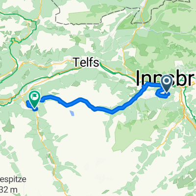
Overview
About this route
Von Innsbruck über den Brenner ins Pustertal und an der Sella vorbei hinab nach Verona und an den Gardasee
- -:--
- Duration
- 418.8 km
- Distance
- 2,288 m
- Ascent
- 2,648 m
- Descent
- ---
- Avg. speed
- ---
- Max. altitude
Route quality
Waytypes & surfaces along the route
Waytypes
Quiet road
100.5 km
(24 %)
Road
79.6 km
(19 %)
Surfaces
Paved
297.4 km
(71 %)
Unpaved
8.4 km
(2 %)
Asphalt
289 km
(69 %)
Paved (undefined)
8.4 km
(2 %)
Route highlights
Points of interest along the route
Point of interest after 0 km
Point of interest after 113.4 km
Ü
Continue with Bikemap
Use, edit, or download this cycling route
You would like to ride von Innsbruck nach Cavaion am Gardasee or customize it for your own trip? Here is what you can do with this Bikemap route:
Free features
- Save this route as favorite or in collections
- Copy & plan your own version of this route
- Split it into stages to create a multi-day tour
- Sync your route with Garmin or Wahoo
Premium features
Free trial for 3 days, or one-time payment. More about Bikemap Premium.
- Navigate this route on iOS & Android
- Export a GPX / KML file of this route
- Create your custom printout (try it for free)
- Download this route for offline navigation
Discover more Premium features.
Get Bikemap PremiumFrom our community
Other popular routes starting in Völs
 IBK-Tumpen
- Distance
- 51.4 km
- Ascent
- 443 m
- Descent
- 123 m
- Location
- Völs, Tyrol, Austria
 Campingplatz Kranebitten - Höttinger Alm
- Distance
- 12.8 km
- Ascent
- 996 m
- Descent
- 122 m
- Location
- Völs, Tyrol, Austria
 Innsbruck - Scuol
- Distance
- 138.5 km
- Ascent
- 1,050 m
- Descent
- 372 m
- Location
- Völs, Tyrol, Austria
 Kühtai Sattel 2009
- Distance
- 55.3 km
- Ascent
- 1,805 m
- Descent
- 1,740 m
- Location
- Völs, Tyrol, Austria
 Innsbruck Route Großer Solberg
- Distance
- 17.4 km
- Ascent
- 2,216 m
- Descent
- 2,214 m
- Location
- Völs, Tyrol, Austria
 Lanser Kopf
- Distance
- 26.6 km
- Ascent
- 387 m
- Descent
- 384 m
- Location
- Völs, Tyrol, Austria
 von Innsbruck nach Cavaion am Gardasee
- Distance
- 418.8 km
- Ascent
- 2,288 m
- Descent
- 2,648 m
- Location
- Völs, Tyrol, Austria
 test
test- Distance
- 5.4 km
- Ascent
- 436 m
- Descent
- 70 m
- Location
- Völs, Tyrol, Austria
Open it in the app