

Bad Hall - Rohr im Kremstal (Ortszentren, Umgehung von Hauptverkehrsstraßen)
A cycling route starting in Bad Hall, Upper Austria, Austria.
Overview
About this route
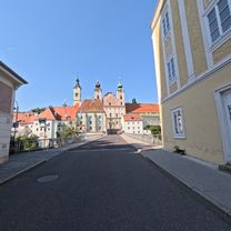
From Bad Hall's main square, head briefly NW, then turn right onto Römerstraße and then right again onto Schulstraße. After crossing the B122, follow the bike path that runs more or less parallel to the road. Shortly after entering the village of Rohr, leave the bike path, turn left onto Waldstraße, then right onto B122, which you can leave to the left after a few meters and now find yourself at the municipal office.
Duration: 10-15 minutes- -:--
- Duration
- 4.4 km
- Distance
- 31 m
- Ascent
- 80 m
- Descent
- ---
- Avg. speed
- ---
- Max. altitude
Route quality
Waytypes & surfaces along the route
Waytypes
Path
1.6 km
(35 %)
Cycleway
1.6 km
(35 %)
Surfaces
Paved
3.5 km
(79 %)
Asphalt
3.5 km
(79 %)
Undefined
0.9 km
(21 %)
Continue with Bikemap
Use, edit, or download this cycling route
You would like to ride Bad Hall - Rohr im Kremstal (Ortszentren, Umgehung von Hauptverkehrsstraßen) or customize it for your own trip? Here is what you can do with this Bikemap route:
Free features
- Save this route as favorite or in collections
- Copy & plan your own version of this route
- Sync your route with Garmin or Wahoo
Premium features
Free trial for 3 days, or one-time payment. More about Bikemap Premium.
- Navigate this route on iOS & Android
- Export a GPX / KML file of this route
- Create your custom printout (try it for free)
- Download this route for offline navigation
Discover more Premium features.
Get Bikemap PremiumFrom our community
Other popular routes starting in Bad Hall
 5 Flüsse Runde
- Distance
- 105.6 km
- Ascent
- 432 m
- Descent
- 426 m
- Location
- Bad Hall, Upper Austria, Austria
 Bad Hall - Enns
- Distance
- 67.5 km
- Ascent
- 632 m
- Descent
- 746 m
- Location
- Bad Hall, Upper Austria, Austria
 Bad Hall - Jageredt - Runde
- Distance
- 36.1 km
- Ascent
- 227 m
- Descent
- 202 m
- Location
- Bad Hall, Upper Austria, Austria
 Rohr Runde
- Distance
- 7.3 km
- Ascent
- 164 m
- Descent
- 174 m
- Location
- Bad Hall, Upper Austria, Austria
 Stollen der Erinnerung, Steyr – Museumssteg Runde von Rohr-Bad Hall. 🚴🚴♂️
- Distance
- 65.9 km
- Ascent
- 606 m
- Descent
- 605 m
- Location
- Bad Hall, Upper Austria, Austria
 2025_05_21_Rohr-Traunbrücke-Kematen-Rohr
- Distance
- 50.1 km
- Ascent
- 535 m
- Descent
- 533 m
- Location
- Bad Hall, Upper Austria, Austria
 353 Mostradler 19
- Distance
- 19.4 km
- Ascent
- 170 m
- Descent
- 170 m
- Location
- Bad Hall, Upper Austria, Austria
 Knackige Fahrt in Bad Hall
- Distance
- 53.8 km
- Ascent
- 943 m
- Descent
- 943 m
- Location
- Bad Hall, Upper Austria, Austria
Open it in the app