

Kirchdorf an der Krems - Micheldorf in Oberösterreich (Ortszentren, Umgehung von Hauptverkehrsstraßen)
A cycling route starting in Micheldorf in Oberösterreich, Upper Austria, Austria.
Overview
About this route
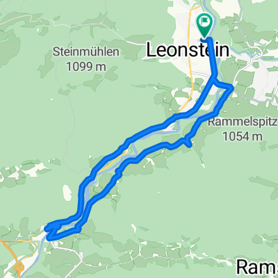
Vom Rathausplatz fährt man über den Kirchenplatz nach rechts in die kirchengasse und dann auf die Parkstraße. Dieser folgt man nun nach Südosten, wobei sie nach etwa 1 km in die Weinzierler Straße übergeht, und nach weiteren 800 m biegt man nach rechts ab, dann nachfolgend wieder links auf Weinzierlerbrücke (nachfolgend Welser Straße). Dieser Straße kann man nun auf etwa 1,5 km weiter nach Süden folgen, dann biegt man nach rechts ab auf den Rathausplatz und ist am Ziel.
Dauer: etwa 10 Minuten- -:--
- Duration
- 3.6 km
- Distance
- 27 m
- Ascent
- 15 m
- Descent
- ---
- Avg. speed
- ---
- Max. altitude
Route quality
Waytypes & surfaces along the route
Waytypes
Quiet road
1.9 km
(52 %)
Road
1.4 km
(39 %)
Surfaces
Paved
2.7 km
(73 %)
Paved (undefined)
1.4 km
(39 %)
Asphalt
1.2 km
(34 %)
Undefined
1 km
(27 %)
Continue with Bikemap
Use, edit, or download this cycling route
You would like to ride Kirchdorf an der Krems - Micheldorf in Oberösterreich (Ortszentren, Umgehung von Hauptverkehrsstraßen) or customize it for your own trip? Here is what you can do with this Bikemap route:
Free features
- Save this route as favorite or in collections
- Copy & plan your own version of this route
- Sync your route with Garmin or Wahoo
Premium features
Free trial for 3 days, or one-time payment. More about Bikemap Premium.
- Navigate this route on iOS & Android
- Export a GPX / KML file of this route
- Create your custom printout (try it for free)
- Download this route for offline navigation
Discover more Premium features.
Get Bikemap PremiumFrom our community
Other popular routes starting in Micheldorf in Oberösterreich
 Route in Grünburg
- Distance
- 27.9 km
- Ascent
- 1,881 m
- Descent
- 1,885 m
- Location
- Micheldorf in Oberösterreich, Upper Austria, Austria
 Zimekrunde
- Distance
- 18.1 km
- Ascent
- 355 m
- Descent
- 356 m
- Location
- Micheldorf in Oberösterreich, Upper Austria, Austria
 Von Klaus an der Pyhrnbahn bis Rosenau am Hengstpaß
- Distance
- 33.1 km
- Ascent
- 1,053 m
- Descent
- 756 m
- Location
- Micheldorf in Oberösterreich, Upper Austria, Austria
 2025_zur Gabi
- Distance
- 7.5 km
- Ascent
- 80 m
- Descent
- 43 m
- Location
- Micheldorf in Oberösterreich, Upper Austria, Austria
 2025_04_29_Micheldorf- Hochberghaus-Micheldorf
- Distance
- 75.1 km
- Ascent
- 1,885 m
- Descent
- 1,886 m
- Location
- Micheldorf in Oberösterreich, Upper Austria, Austria
 Hochbaumgarten - Haindlmühle-Graben - Hochbaumgarten
- Distance
- 16.2 km
- Ascent
- 502 m
- Descent
- 493 m
- Location
- Micheldorf in Oberösterreich, Upper Austria, Austria
 2025_04_14_Micheldorf-Weyregg
- Distance
- 70.8 km
- Ascent
- 1,870 m
- Descent
- 1,851 m
- Location
- Micheldorf in Oberösterreich, Upper Austria, Austria
 Micheld. Sattlhald ZiehbergSender Lauterbach
- Distance
- 33.7 km
- Ascent
- 969 m
- Descent
- 969 m
- Location
- Micheldorf in Oberösterreich, Upper Austria, Austria
Open it in the app