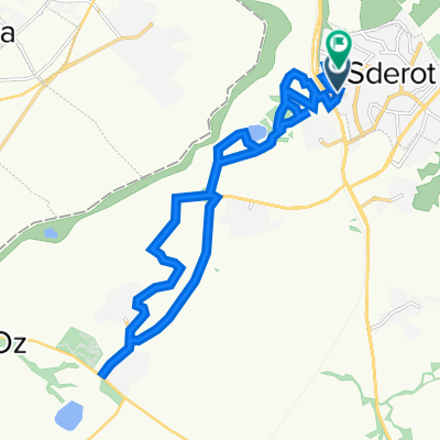
עוקף נתיבות 65 קמ
A cycling route starting in Sderot, Southern District, Israel.
Overview
About this route
עוקף נתיבות
נקודת התחלה וסיום צומת כביש שדרות/באר שבע והכביש למפלסים.- -:--
- Duration
- 64.9 km
- Distance
- 242 m
- Ascent
- 238 m
- Descent
- ---
- Avg. speed
- ---
- Avg. speed
Continue with Bikemap
Use, edit, or download this cycling route
You would like to ride עוקף נתיבות 65 קמ or customize it for your own trip? Here is what you can do with this Bikemap route:
Free features
- Save this route as favorite or in collections
- Copy & plan your own version of this route
- Sync your route with Garmin or Wahoo
Premium features
Free trial for 3 days, or one-time payment. More about Bikemap Premium.
- Navigate this route on iOS & Android
- Export a GPX / KML file of this route
- Create your custom printout (try it for free)
- Download this route for offline navigation
Discover more Premium features.
Get Bikemap PremiumFrom our community
Other popular routes starting in Sderot
- דרך נוף to דרך נוף
- Distance
- 11.8 km
- Ascent
- 78 m
- Descent
- 64 m
- Location
- Sderot, Southern District, Israel
- סובב אור הנר - מעגלי משדרות
- Distance
- 14.3 km
- Ascent
- 76 m
- Descent
- 78 m
- Location
- Sderot, Southern District, Israel
- רוחמה סובב צפוני 42 קמ
- Distance
- 43 km
- Ascent
- 74 m
- Descent
- 74 m
- Location
- Sderot, Southern District, Israel
- 13.07.19
- Distance
- 96.1 km
- Ascent
- 372 m
- Descent
- 401 m
- Location
- Sderot, Southern District, Israel
- suuntoapp-MountainBiking-2025-03-28T05-11-23Z
- Distance
- 20.6 km
- Ascent
- ---
- Descent
- ---
- Location
- Sderot, Southern District, Israel
- GPS Logger 20250127-071909 - Track 20250127-071909
- Distance
- 19.7 km
- Ascent
- 219 m
- Descent
- 215 m
- Location
- Sderot, Southern District, Israel
- עוקף נתיבות 65 קמ
- Distance
- 64.9 km
- Ascent
- 242 m
- Descent
- 238 m
- Location
- Sderot, Southern District, Israel
- גברעם
- Distance
- 18.8 km
- Ascent
- 208 m
- Descent
- 211 m
- Location
- Sderot, Southern District, Israel
Open it in the app