kleine Runde am Morgen
- 27.7 km
- 63 m
- 43 m
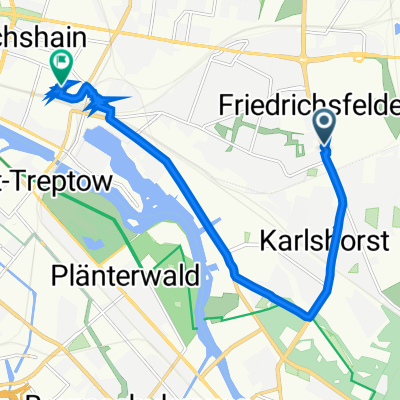
- Friedrichsfelde, State of Berlin, Germany
A cycling route starting in Friedrichsfelde, State of Berlin, Germany.
Overview
A relaxed ride for autumn without particular difficulties. Annoying are the many traffic lights and poor bike paths within Berlin. For those interested in a group ride, I am on this route almost every weekend. I take about 4 hours for the route at a moderate pace.
created this 16 years ago
Route quality
Path
27.8 km
28 %
Quiet road
15.9 km
16 %
Paved
70.6 km
(71 %)
Unpaved
9.9 km
(10 %)
Asphalt
65.6 km
66 %
Concrete
4 km
4 %
Continue with Bikemap
You would like to ride Berliner Umland 1 or customize it for your own trip? Here is what you can do with this Bikemap route:
Free trial for 3 days, or one-time payment. More about Bikemap Premium.
Discover more Premium features.
Get Bikemap PremiumFrom our community
Open it in the app