Thorpe - Youlgreave - Darley Bridge - Matlock - Riber - Cromford - Wirksworth - Kirk Ireton - Carsington Water - Tissington - Thorpe
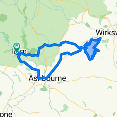
A cycling route starting in Ashbourne, England, United Kingdom.
Overview
About this route
A road bike run around the peak district.
(cloned from route 3341165)
- -:--
- Duration
- 69 km
- Distance
- 867 m
- Ascent
- 868 m
- Descent
- ---
- Avg. speed
- ---
- Avg. speed
Route quality
Waytypes & surfaces along the route
Waytypes
Road
24.9 km
(36 %)
Quiet road
20.6 km
(30 %)
Surfaces
Paved
17.4 km
(25 %)
Unpaved
3.7 km
(5 %)
Asphalt
17.1 km
(25 %)
Gravel
3.3 km
(5 %)
Continue with Bikemap
Use, edit, or download this cycling route
You would like to ride Thorpe - Youlgreave - Darley Bridge - Matlock - Riber - Cromford - Wirksworth - Kirk Ireton - Carsington Water - Tissington - Thorpe or customize it for your own trip? Here is what you can do with this Bikemap route:
Free features
- Save this route as favorite or in collections
- Copy & plan your own version of this route
- Sync your route with Garmin or Wahoo
Premium features
Free trial for 3 days, or one-time payment. More about Bikemap Premium.
- Navigate this route on iOS & Android
- Export a GPX / KML file of this route
- Create your custom printout (try it for free)
- Download this route for offline navigation
Discover more Premium features.
Get Bikemap PremiumFrom our community
Other popular routes starting in Ashbourne
- Tissington Trail
- Distance
- 39.8 km
- Ascent
- 518 m
- Descent
- 486 m
- Location
- Ashbourne, England, United Kingdom
- Route 10 Carsington Water circular
- Distance
- 43.6 km
- Ascent
- 513 m
- Descent
- 514 m
- Location
- Ashbourne, England, United Kingdom
- Ashbourne - Alstonefield loop
- Distance
- 26.1 km
- Ascent
- 486 m
- Descent
- 485 m
- Location
- Ashbourne, England, United Kingdom
- Milldale - Hall Dale Walk
- Distance
- 10.5 km
- Ascent
- 247 m
- Descent
- 248 m
- Location
- Ashbourne, England, United Kingdom
- Tissington and High Peak Trails (and the roady thing to join up the ends)
- Distance
- 55.6 km
- Ascent
- 437 m
- Descent
- 437 m
- Location
- Ashbourne, England, United Kingdom
- Flashy Manifold Trail
- Distance
- 77.5 km
- Ascent
- 1,186 m
- Descent
- 1,187 m
- Location
- Ashbourne, England, United Kingdom
- 09.2018 Cov-M'cr-Cov. Dzien 2/3
- Distance
- 59.4 km
- Ascent
- 491 m
- Descent
- 783 m
- Location
- Ashbourne, England, United Kingdom
- ride in the peak district
- Distance
- 50.1 km
- Ascent
- 723 m
- Descent
- 723 m
- Location
- Ashbourne, England, United Kingdom