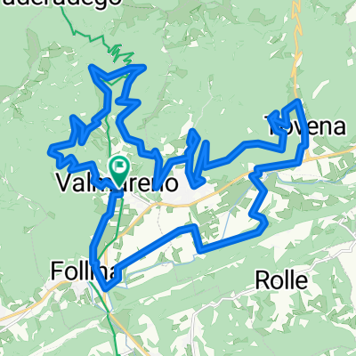
Day 1: Cison Di Valmarino – Belluno
- 61.7 km
- 1,589 m
- 1,429 m
- Cison di Valmarino, Veneto, Italy
A cycling route starting in Cison di Valmarino, Veneto, Italy.
Overview
Stats: 111 kilometres, and 2,950m of climbing
Major Climbs: Passo Praderadego (910m), Passo Nevegal The stunning Castelbrando at Cison, is an incredible starting point to discover the Dolomites. The road to Praderadego will lift you out of the hassles of everyday life and settle you in for the mountainous roads ahead. The climb to Nevegal will test the legs, but the view from the top will calm the pain, before you descend towards Belluno and Villa Carpenada.Cison di Valmarino, TVRoute quality
Road
30.8 km
(50 %)
Quiet road
19.7 km
(32 %)
Paved
41.3 km
(67 %)
Unpaved
3.7 km
(6 %)
Asphalt
41.3 km
(67 %)
Unpaved (undefined)
3.1 km
(5 %)
Continue with Bikemap
You would like to ride Day 1: Cison Di Valmarino – Belluno or customize it for your own trip? Here is what you can do with this Bikemap route:
Free trial for 3 days, or one-time payment. More about Bikemap Premium.
Discover more Premium features.
Get Bikemap PremiumFrom our community
Open it in the app