

Tour de Karpaty 2015 dzień 4
A cycling route starting in Levelek, Szabolcs-Szatmár-Bereg, Hungary.
Overview
About this route
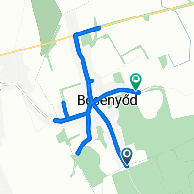
Apagy – LEVELEK (Ady Endre-Rakoczi) – Besenyod (Kossuth) – OFEHERTO (Uttoro-Szabadsag) – Kantorjanosi (Marx Karoly) – Hodasz (Kossuth Lajos) – Nyirmeggyes (471) – MATESZALKA (49) – Kocsord – Gyortelek – Okoritofulpos – Porcsalma – Patyod – Csenger – (granica węgiersko-rumuńska) – Oar – Vetis – SATU MARE (E81-19) – Botiz – Ciuperceni – Livada – (19-197) – Pasunea Mare – Coca (jezioro Calinesti)
(cloned from route 3230211)- -:--
- Duration
- 120.1 km
- Distance
- 157 m
- Ascent
- 136 m
- Descent
- ---
- Avg. speed
- ---
- Max. altitude

Continue with Bikemap
Use, edit, or download this cycling route
You would like to ride Tour de Karpaty 2015 dzień 4 or customize it for your own trip? Here is what you can do with this Bikemap route:
Free features
- Save this route as favorite or in collections
- Copy & plan your own version of this route
- Split it into stages to create a multi-day tour
- Sync your route with Garmin or Wahoo
Premium features
Free trial for 3 days, or one-time payment. More about Bikemap Premium.
- Navigate this route on iOS & Android
- Export a GPX / KML file of this route
- Create your custom printout (try it for free)
- Download this route for offline navigation
Discover more Premium features.
Get Bikemap PremiumFrom our community
Other popular routes starting in Levelek
 Tour de Karpaty 2015 dzień 4
- Distance
- 120.1 km
- Ascent
- 157 m
- Descent
- 136 m
- Location
- Levelek, Szabolcs-Szatmár-Bereg, Hungary
 Besenyődi út, Ófehértó to Úttörő utca 35, Ófehértó
- Distance
- 31.9 km
- Ascent
- 342 m
- Descent
- 335 m
- Location
- Levelek, Szabolcs-Szatmár-Bereg, Hungary
 Recovered Route
- Distance
- 33.7 km
- Ascent
- 103 m
- Descent
- 106 m
- Location
- Levelek, Szabolcs-Szatmár-Bereg, Hungary
 📍Besenyőd ▫️2025.09.09.
- Distance
- 7.7 km
- Ascent
- 3 m
- Descent
- 6 m
- Location
- Levelek, Szabolcs-Szatmár-Bereg, Hungary
 Tompa Mihály utca 6., Magy to Hunyadi utca 2–40., Levelek
- Distance
- 4 km
- Ascent
- 0 m
- Descent
- 3 m
- Location
- Levelek, Szabolcs-Szatmár-Bereg, Hungary
 4926 54, Levelek to Kossuth Lajos utca 53, Levelek
- Distance
- 5.8 km
- Ascent
- 13 m
- Descent
- 16 m
- Location
- Levelek, Szabolcs-Szatmár-Bereg, Hungary
 Táncsics Mihály utca 8., Levelek to Kossuth Lajos utca 6., Magy
- Distance
- 3.7 km
- Ascent
- 13 m
- Descent
- 13 m
- Location
- Levelek, Szabolcs-Szatmár-Bereg, Hungary
 Hunyadi utca 2–40., Levelek to Strand utca 13–22., Levelek
- Distance
- 2.9 km
- Ascent
- 0 m
- Descent
- 16 m
- Location
- Levelek, Szabolcs-Szatmár-Bereg, Hungary
Open it in the app