
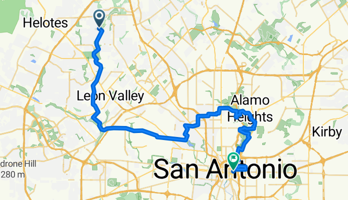
Baumberger Park to the Alamo
A cycling route starting in Helotes, Texas, United States.
Overview
About this route
Baumberger Park to Ingram, Ingram to St. Mary's, St. Mary's to Woodlawn Lake, Woodlawn Lake to St. Mary Magdalen Bridge, SMM Bridge to Contour Drive, Contour Drive to Incarnate Word Bridge, IW Bridge to Brackenridge Park, Brack to Downtown.
- -:--
- Duration
- 48.9 km
- Distance
- 167 m
- Ascent
- 249 m
- Descent
- ---
- Avg. speed
- ---
- Max. altitude
Route quality
Waytypes & surfaces along the route
Waytypes
Quiet road
18.6 km
(38 %)
Cycleway
14.7 km
(30 %)
Surfaces
Paved
25.4 km
(52 %)
Concrete
13.7 km
(28 %)
Asphalt
11.7 km
(24 %)
Undefined
23.5 km
(48 %)
Continue with Bikemap
Use, edit, or download this cycling route
You would like to ride Baumberger Park to the Alamo or customize it for your own trip? Here is what you can do with this Bikemap route:
Free features
- Save this route as favorite or in collections
- Copy & plan your own version of this route
- Sync your route with Garmin or Wahoo
Premium features
Free trial for 3 days, or one-time payment. More about Bikemap Premium.
- Navigate this route on iOS & Android
- Export a GPX / KML file of this route
- Create your custom printout (try it for free)
- Download this route for offline navigation
Discover more Premium features.
Get Bikemap PremiumFrom our community
Other popular routes starting in Helotes
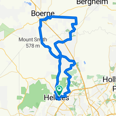
 34 mile - May Elementary to Boerne
- Distance
- 54.3 km
- Ascent
- 299 m
- Descent
- 299 m
- Location
- Helotes, Texas, United States
 8814 Firebaugh Dr, San Antonio to 8810 Firebaugh Dr, San Antonio
- Distance
- 59.7 km
- Ascent
- 482 m
- Descent
- 481 m
- Location
- Helotes, Texas, United States
 Helotes 13-mile training route
- Distance
- 24.9 km
- Ascent
- 192 m
- Descent
- 191 m
- Location
- Helotes, Texas, United States
 Scenic to Boerne Lake
- Distance
- 32.7 km
- Ascent
- 265 m
- Descent
- 117 m
- Location
- Helotes, Texas, United States
 Helotes - Scenic Loop
- Distance
- 53.8 km
- Ascent
- 357 m
- Descent
- 355 m
- Location
- Helotes, Texas, United States
 Helotes-Boerne loop
- Distance
- 86.9 km
- Ascent
- 494 m
- Descent
- 494 m
- Location
- Helotes, Texas, United States
 Kyle Seale Babcock
- Distance
- 12.6 km
- Ascent
- 134 m
- Descent
- 132 m
- Location
- Helotes, Texas, United States
 4 County Loop.
- Distance
- 111.3 km
- Ascent
- 969 m
- Descent
- 952 m
- Location
- Helotes, Texas, United States
Open it in the app