


Petra
- 35.1 km
- 314 m
- 262 m
- Vilafranca de Bonany, Balearic Islands, Spain
Vilafranca de Bonany, Mallorca
A cycling route starting in Vilafranca de Bonany, Balearic Islands, Spain.
Overview
Flat route to start building legs after a long time without riding. Delicious!
created this 10 years ago
Part of
Vilafranca de Bonany, Mallorca
2 stages


Route quality
Quiet road
23.8 km
(71 %)
Road
3.3 km
(10 %)
Paved
17.7 km
(53 %)
Unpaved
1 km
(3 %)
Asphalt
17.4 km
(52 %)
Gravel
1 km
(3 %)
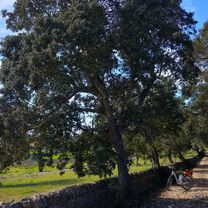
Route highlights


Continue with Bikemap
You would like to ride Mallorca: Vilafranca-Porreres-Vilafranca or customize it for your own trip? Here is what you can do with this Bikemap route:
Free trial for 3 days, or one-time payment. More about Bikemap Premium.
Discover more Premium features.
Get Bikemap PremiumFrom our community
Open it in the app


