Reprise_12_2015_2
A cycling route starting in Lézignan-Corbières, Languedoc-Roussillon-Midi-Pyrénées, France.
Overview
About this route
Reprise_12_2015_2
Faire du plat , tourner les gambettes- -:--
- Duration
- 52.1 km
- Distance
- 147 m
- Ascent
- 149 m
- Descent
- ---
- Avg. speed
- ---
- Max. altitude
Route quality
Waytypes & surfaces along the route
Waytypes
Busy road
22.2 km
(43 %)
Road
18.7 km
(36 %)
Surfaces
Paved
19.4 km
(37 %)
Unpaved
0.8 km
(2 %)
Asphalt
15 km
(29 %)
Paved (undefined)
4.3 km
(8 %)
Continue with Bikemap
Use, edit, or download this cycling route
You would like to ride Reprise_12_2015_2 or customize it for your own trip? Here is what you can do with this Bikemap route:
Free features
- Save this route as favorite or in collections
- Copy & plan your own version of this route
- Sync your route with Garmin or Wahoo
Premium features
Free trial for 3 days, or one-time payment. More about Bikemap Premium.
- Navigate this route on iOS & Android
- Export a GPX / KML file of this route
- Create your custom printout (try it for free)
- Download this route for offline navigation
Discover more Premium features.
Get Bikemap PremiumFrom our community
Other popular routes starting in Lézignan-Corbières
- Minervoise
- Distance
- 118.1 km
- Ascent
- 1,265 m
- Descent
- 1,266 m
- Location
- Lézignan-Corbières, Languedoc-Roussillon-Midi-Pyrénées, France
- Canal Du Midi Lézignan - Béziers
- Distance
- 56.8 km
- Ascent
- 150 m
- Descent
- 138 m
- Location
- Lézignan-Corbières, Languedoc-Roussillon-Midi-Pyrénées, France
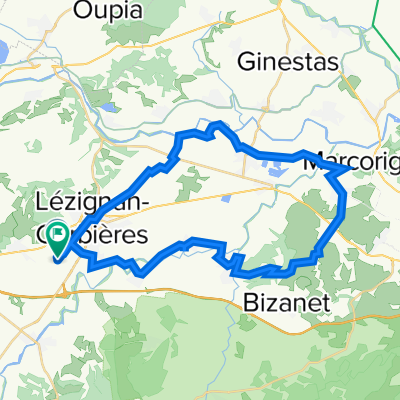
- Lézignan _ Banyuls del Aspres
- Distance
- 108.1 km
- Ascent
- 776 m
- Descent
- 726 m
- Location
- Lézignan-Corbières, Languedoc-Roussillon-Midi-Pyrénées, France
- Lezignan Ride
- Distance
- 43.3 km
- Ascent
- 240 m
- Descent
- 241 m
- Location
- Lézignan-Corbières, Languedoc-Roussillon-Midi-Pyrénées, France
- camping La Pinnede Puicheric
- Distance
- 18 km
- Ascent
- 88 m
- Descent
- 87 m
- Location
- Lézignan-Corbières, Languedoc-Roussillon-Midi-Pyrénées, France
- Conilhac-Corbières
- Distance
- 35.2 km
- Ascent
- 729 m
- Descent
- 731 m
- Location
- Lézignan-Corbières, Languedoc-Roussillon-Midi-Pyrénées, France
- Lézignan - Banyuls del Aspres
- Distance
- 104.8 km
- Ascent
- 614 m
- Descent
- 578 m
- Location
- Lézignan-Corbières, Languedoc-Roussillon-Midi-Pyrénées, France
- Reprise_12_2015
- Distance
- 44.2 km
- Ascent
- 287 m
- Descent
- 289 m
- Location
- Lézignan-Corbières, Languedoc-Roussillon-Midi-Pyrénées, France
Open it in the app