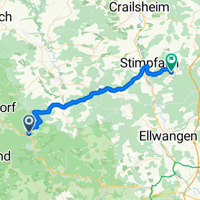
Hagbergturm u. Berge rund um Gschwend
A cycling route starting in Gerabronn, Baden-Wurttemberg, Germany.
Overview
About this route
Through Kochertal, we go in Unterrot through the forest to Reippersberg. About 2 km after Honkling, a piece of singletrail up to Hagberg. Then across hilly forest roads and singletrail to Birkhof. From here, back via moderately to lightly trafficked roads towards Kochertal. At the end, an extra mountain segment back up to Krasberg and over Nestelberg back into the valley.
- -:--
- Duration
- 46.3 km
- Distance
- 739 m
- Ascent
- 675 m
- Descent
- ---
- Avg. speed
- 581 m
- Max. altitude
Route quality
Waytypes & surfaces along the route
Waytypes
Road
15.7 km
(34 %)
Quiet road
13.4 km
(29 %)
Surfaces
Paved
14.4 km
(31 %)
Unpaved
7.9 km
(17 %)
Asphalt
11.6 km
(25 %)
Gravel
5.6 km
(12 %)
Continue with Bikemap
Use, edit, or download this cycling route
You would like to ride Hagbergturm u. Berge rund um Gschwend or customize it for your own trip? Here is what you can do with this Bikemap route:
Free features
- Save this route as favorite or in collections
- Copy & plan your own version of this route
- Sync your route with Garmin or Wahoo
Premium features
Free trial for 3 days, or one-time payment. More about Bikemap Premium.
- Navigate this route on iOS & Android
- Export a GPX / KML file of this route
- Create your custom printout (try it for free)
- Download this route for offline navigation
Discover more Premium features.
Get Bikemap PremiumFrom our community
Other popular routes starting in Gerabronn
3Berge Tour010421- Distance
- 43.6 km
- Ascent
- 747 m
- Descent
- 740 m
- Location
- Gerabronn, Baden-Wurttemberg, Germany
FDR Sulzbach aK - U'gröningen - Pommertsweiler - Hammerschmiede - Heilberg - Altenbergturm - Sulbach aK- Distance
- 53 km
- Ascent
- 762 m
- Descent
- 766 m
- Location
- Gerabronn, Baden-Wurttemberg, Germany
Schnelle MTB Herbst Runde- Distance
- 52.4 km
- Ascent
- 569 m
- Descent
- 569 m
- Location
- Gerabronn, Baden-Wurttemberg, Germany
2Turm Tour 230421- Distance
- 44.2 km
- Ascent
- 761 m
- Descent
- 759 m
- Location
- Gerabronn, Baden-Wurttemberg, Germany
Hagbergturm u. Berge rund um Gschwend- Distance
- 46.3 km
- Ascent
- 739 m
- Descent
- 675 m
- Location
- Gerabronn, Baden-Wurttemberg, Germany
50km Wäldertour- Distance
- 50.7 km
- Ascent
- 721 m
- Descent
- 660 m
- Location
- Gerabronn, Baden-Wurttemberg, Germany
RR Runde Kochertal-Bühlertal-Jagsttal- Distance
- 70.9 km
- Ascent
- 785 m
- Descent
- 736 m
- Location
- Gerabronn, Baden-Wurttemberg, Germany
Bühlertaltour- Distance
- 43.7 km
- Ascent
- 566 m
- Descent
- 539 m
- Location
- Gerabronn, Baden-Wurttemberg, Germany
Open it in the app

