

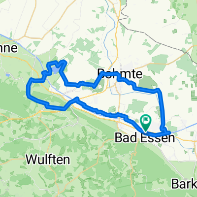
Altes Berghaus, Empterweg 2, 49152 Bad Essen
A cycling route starting in Bad Essen, Lower Saxony, Germany.
Overview
About this route
Destination: Altes Berghaus, Empterweg 2, 49152 Bad Essen
- -:--
- Duration
- 19.1 km
- Distance
- 194 m
- Ascent
- 266 m
- Descent
- ---
- Avg. speed
- ---
- Max. altitude
Route quality
Waytypes & surfaces along the route
Waytypes
Quiet road
10.5 km
(55 %)
Road
5.7 km
(30 %)
Surfaces
Paved
18 km
(94 %)
Unpaved
0.4 km
(2 %)
Asphalt
15.3 km
(80 %)
Paved (undefined)
2.7 km
(14 %)
Continue with Bikemap
Use, edit, or download this cycling route
You would like to ride Altes Berghaus, Empterweg 2, 49152 Bad Essen or customize it for your own trip? Here is what you can do with this Bikemap route:
Free features
- Save this route as favorite or in collections
- Copy & plan your own version of this route
- Sync your route with Garmin or Wahoo
Premium features
Free trial for 3 days, or one-time payment. More about Bikemap Premium.
- Navigate this route on iOS & Android
- Export a GPX / KML file of this route
- Create your custom printout (try it for free)
- Download this route for offline navigation
Discover more Premium features.
Get Bikemap PremiumFrom our community
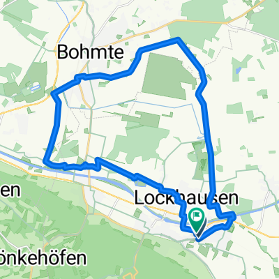
Other popular routes starting in Bad Essen
 Hügeltour II.
- Distance
- 84.6 km
- Ascent
- 881 m
- Descent
- 879 m
- Location
- Bad Essen, Lower Saxony, Germany
 ZF-Strecke
- Distance
- 8.1 km
- Ascent
- 139 m
- Descent
- 79 m
- Location
- Bad Essen, Lower Saxony, Germany
 D008-RundUmBadEssen-43km
- Distance
- 42.9 km
- Ascent
- 269 m
- Descent
- 265 m
- Location
- Bad Essen, Lower Saxony, Germany
 Lindenstraße, Bad Essen nach Dorfstraße, Bad Essen
- Distance
- 20.9 km
- Ascent
- 41 m
- Descent
- 41 m
- Location
- Bad Essen, Lower Saxony, Germany
 Denkmalsweg 1, Bad Essen nach Wehrendorfer Bergstraße 4, Bad Essen
- Distance
- 32.5 km
- Ascent
- 372 m
- Descent
- 322 m
- Location
- Bad Essen, Lower Saxony, Germany
 Bad Essen - Kronensee
- Distance
- 37.1 km
- Ascent
- 125 m
- Descent
- 126 m
- Location
- Bad Essen, Lower Saxony, Germany
 Bad Essen im Süden
- Distance
- 42.2 km
- Ascent
- 464 m
- Descent
- 463 m
- Location
- Bad Essen, Lower Saxony, Germany
 Bad Essen - Waldtour
- Distance
- 17.5 km
- Ascent
- 205 m
- Descent
- 226 m
- Location
- Bad Essen, Lower Saxony, Germany
Open it in the app