

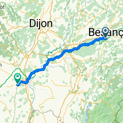
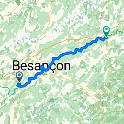
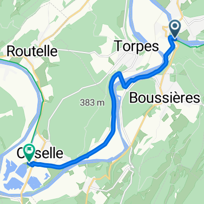
Besancon Arbois
A cycling route starting in Montferrand-le-Château, Bourgogne-Franche-Comté, France.
Overview
About this route
Vom Kanal an der Doub Abrahrt über das Land nach Arbois
- -:--
- Duration
- 40.4 km
- Distance
- 462 m
- Ascent
- 416 m
- Descent
- ---
- Avg. speed
- ---
- Max. altitude

Route quality
Waytypes & surfaces along the route
Waytypes
Road
16.3 km
(40 %)
Busy road
13.1 km
(32 %)
Surfaces
Paved
26.5 km
(66 %)
Asphalt
26.5 km
(66 %)
Undefined
13.9 km
(34 %)
Continue with Bikemap
Use, edit, or download this cycling route
You would like to ride Besancon Arbois or customize it for your own trip? Here is what you can do with this Bikemap route:
Free features
- Save this route as favorite or in collections
- Copy & plan your own version of this route
- Sync your route with Garmin or Wahoo
Premium features
Free trial for 3 days, or one-time payment. More about Bikemap Premium.
- Navigate this route on iOS & Android
- Export a GPX / KML file of this route
- Create your custom printout (try it for free)
- Download this route for offline navigation
Discover more Premium features.
Get Bikemap PremiumFrom our community
Other popular routes starting in Montferrand-le-Château
 Montferrand-le-Château - Givry
- Distance
- 130.6 km
- Ascent
- 583 m
- Descent
- 601 m
- Location
- Montferrand-le-Château, Bourgogne-Franche-Comté, France
 Camino 5 lipca
- Distance
- 66.8 km
- Ascent
- 207 m
- Descent
- 280 m
- Location
- Montferrand-le-Château, Bourgogne-Franche-Comté, France
 Voie comme un escargot dans Doleje
- Distance
- 44.1 km
- Ascent
- 369 m
- Descent
- 367 m
- Location
- Montferrand-le-Château, Bourgogne-Franche-Comté, France
 Rue du Centre nach Rue de la Gilebarde
- Distance
- 55.6 km
- Ascent
- 574 m
- Descent
- 529 m
- Location
- Montferrand-le-Château, Bourgogne-Franche-Comté, France
 Route de Boussières nach Grande Rue
- Distance
- 8 km
- Ascent
- 94 m
- Descent
- 158 m
- Location
- Montferrand-le-Château, Bourgogne-Franche-Comté, France
 De Route de Boussières 1, Thoraise à Rue Louis Pergaud 4c, Besançon
- Distance
- 15.4 km
- Ascent
- 142 m
- Descent
- 141 m
- Location
- Montferrand-le-Château, Bourgogne-Franche-Comté, France
 Besancon Lons le Saunier
- Distance
- 79.7 km
- Ascent
- 496 m
- Descent
- 476 m
- Location
- Montferrand-le-Château, Bourgogne-Franche-Comté, France
 Besancon Arbois
- Distance
- 40.4 km
- Ascent
- 462 m
- Descent
- 416 m
- Location
- Montferrand-le-Château, Bourgogne-Franche-Comté, France
Open it in the app