

Ried im Traunkreis - Wartberg an der Krems (Ortszentren, Umgehung von Hauptverkehrsstraßen)
A cycling route starting in Sattledt, Upper Austria, Austria.
Overview
About this route
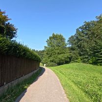
Vom Gemeindezentrum geht es nach rechts auf die Hauptstraße und auf dieser bergab und in der folgenden Rechtskurve nach links auf die Penzendorfer Straße. Auf dieser lässt sich nun auf 2 km durch hügeliges Terrain mit sehr ländlichem Flair fahren. Anschließend geht es teilweise recht steil bergab Richtung Kremstal. Bevor man allerdings die Krems erreicht, muss man sich rechts halten, fährt nun die letzten 2 km den Roßlauf entlang bis ins Wartberger Zentrum, wo sich linkerseits Kirche und Gemeindezentrum befinden.
Dauer: etwa 20 Minuten- -:--
- Duration
- 6.3 km
- Distance
- 58 m
- Ascent
- 141 m
- Descent
- ---
- Avg. speed
- ---
- Max. altitude
Route quality
Waytypes & surfaces along the route
Waytypes
Quiet road
5.9 km
(94 %)
Busy road
0.3 km
(4 %)
Surfaces
Paved
1.9 km
(30 %)
Asphalt
1.9 km
(30 %)
Undefined
4.4 km
(70 %)
Continue with Bikemap
Use, edit, or download this cycling route
You would like to ride Ried im Traunkreis - Wartberg an der Krems (Ortszentren, Umgehung von Hauptverkehrsstraßen) or customize it for your own trip? Here is what you can do with this Bikemap route:
Free features
- Save this route as favorite or in collections
- Copy & plan your own version of this route
- Sync your route with Garmin or Wahoo
Premium features
Free trial for 3 days, or one-time payment. More about Bikemap Premium.
- Navigate this route on iOS & Android
- Export a GPX / KML file of this route
- Create your custom printout (try it for free)
- Download this route for offline navigation
Discover more Premium features.
Get Bikemap PremiumFrom our community
Other popular routes starting in Sattledt
 Recovered Route
- Distance
- 13.1 km
- Ascent
- 165 m
- Descent
- 171 m
- Location
- Sattledt, Upper Austria, Austria
 Fischlham Pizza
- Distance
- 10.4 km
- Ascent
- 90 m
- Descent
- 134 m
- Location
- Sattledt, Upper Austria, Austria
 Schloss Achleiten – die Krems Runde von Sattledt. 🚴♂️🚴
- Distance
- 56.1 km
- Ascent
- 569 m
- Descent
- 568 m
- Location
- Sattledt, Upper Austria, Austria
 Tour BWimsbAußerrohVorchdSpield
- Distance
- 42.8 km
- Ascent
- 296 m
- Descent
- 296 m
- Location
- Sattledt, Upper Austria, Austria
 Kremsmünster Hin
- Distance
- 9.2 km
- Ascent
- 83 m
- Descent
- 95 m
- Location
- Sattledt, Upper Austria, Austria
 Maria am Wege Kapelle – Blick auf den Traunstein Runde von Sattledt
- Distance
- 69.8 km
- Ascent
- 545 m
- Descent
- 546 m
- Location
- Sattledt, Upper Austria, Austria
 Ried im Traunkreis - Wartberg an der Krems (Ortszentren, Umgehung von Hauptverkehrsstraßen)
- Distance
- 6.3 km
- Ascent
- 58 m
- Descent
- 141 m
- Location
- Sattledt, Upper Austria, Austria
 schwarzi Runde
- Distance
- 11.9 km
- Ascent
- 110 m
- Descent
- 113 m
- Location
- Sattledt, Upper Austria, Austria
Open it in the app