

ViaDei4
A cycling route starting in Galliano, Tuscany, Italy.
Overview
About this route
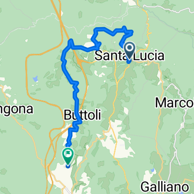
Via degli Dei from Monte di Fò to San Piero a Sieve
- -:--
- Duration
- 21.9 km
- Distance
- 516 m
- Ascent
- 1,055 m
- Descent
- ---
- Avg. speed
- ---
- Max. altitude

Continue with Bikemap
Use, edit, or download this cycling route
You would like to ride ViaDei4 or customize it for your own trip? Here is what you can do with this Bikemap route:
Free features
- Save this route as favorite or in collections
- Copy & plan your own version of this route
- Sync your route with Garmin or Wahoo
Premium features
Free trial for 3 days, or one-time payment. More about Bikemap Premium.
- Navigate this route on iOS & Android
- Export a GPX / KML file of this route
- Create your custom printout (try it for free)
- Download this route for offline navigation
Discover more Premium features.
Get Bikemap PremiumFrom our community
Other popular routes starting in Galliano
 ViaDei3
- Distance
- 17.3 km
- Ascent
- 663 m
- Descent
- 636 m
- Location
- Galliano, Tuscany, Italy
 1T5 Santa Lucia - San Piero a Sieve
- Distance
- 24.5 km
- Ascent
- 624 m
- Descent
- 1,141 m
- Location
- Galliano, Tuscany, Italy
 Toscana_MonteDiFo_PassoDelleGiogo
- Distance
- 38.5 km
- Ascent
- 848 m
- Descent
- 759 m
- Location
- Galliano, Tuscany, Italy
 Fonte dei Seppi
- Distance
- 61.5 km
- Ascent
- 1,337 m
- Descent
- 1,331 m
- Location
- Galliano, Tuscany, Italy
 Via degli Dei: Monte di Fò- San Piero a Sieve
- Distance
- 26 km
- Ascent
- 407 m
- Descent
- 982 m
- Location
- Galliano, Tuscany, Italy
 Monte di Fo - Camping Mugello verde ( San Piero a Sieve )
- Distance
- 17.2 km
- Ascent
- 124 m
- Descent
- 665 m
- Location
- Galliano, Tuscany, Italy
 S.Lucia Ruzza con ?
- Distance
- 15.7 km
- Ascent
- 236 m
- Descent
- 595 m
- Location
- Galliano, Tuscany, Italy
 ViaDei4
- Distance
- 21.9 km
- Ascent
- 516 m
- Descent
- 1,055 m
- Location
- Galliano, Tuscany, Italy
Open it in the app