

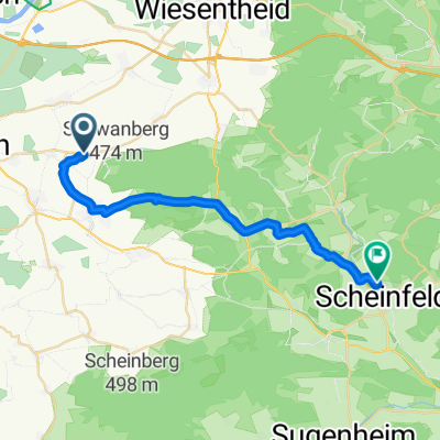
Schwanberg - Castell
A cycling route starting in Rödelsee, Bavaria, Germany.
Overview
About this route
Schwanberg - Birkensee - Ruine Castell - Keltenweg zum Schwanberg
- -:--
- Duration
- 25.4 km
- Distance
- 412 m
- Ascent
- 403 m
- Descent
- ---
- Avg. speed
- ---
- Max. altitude
Continue with Bikemap
Use, edit, or download this cycling route
You would like to ride Schwanberg - Castell or customize it for your own trip? Here is what you can do with this Bikemap route:
Free features
- Save this route as favorite or in collections
- Copy & plan your own version of this route
- Sync your route with Garmin or Wahoo
Premium features
Free trial for 3 days, or one-time payment. More about Bikemap Premium.
- Navigate this route on iOS & Android
- Export a GPX / KML file of this route
- Create your custom printout (try it for free)
- Download this route for offline navigation
Discover more Premium features.
Get Bikemap PremiumFrom our community
Other popular routes starting in Rödelsee
 SCF Frankentour 2 Scheinfeld
- Distance
- 67.5 km
- Ascent
- 598 m
- Descent
- 598 m
- Location
- Rödelsee, Bavaria, Germany
 Wanderweg: Naturpark Steigerwald, Blaues Dreieck (Rödelsee-Weingartsgreuth)
- Distance
- 43.6 km
- Ascent
- 633 m
- Descent
- 571 m
- Location
- Rödelsee, Bavaria, Germany
 TGS Tour 26.09.21
- Distance
- 158.9 km
- Ascent
- 788 m
- Descent
- 917 m
- Location
- Rödelsee, Bavaria, Germany
 Schwanberg - Castell
- Distance
- 25.4 km
- Ascent
- 412 m
- Descent
- 403 m
- Location
- Rödelsee, Bavaria, Germany
 Schwanberg_Wanderung
- Distance
- 8.5 km
- Ascent
- 266 m
- Descent
- 266 m
- Location
- Rödelsee, Bavaria, Germany
 Relaxed route in Scheinfeld
- Distance
- 22.6 km
- Ascent
- 250 m
- Descent
- 206 m
- Location
- Rödelsee, Bavaria, Germany
 Schwanberg Rödelsee
- Distance
- 4.9 km
- Ascent
- 207 m
- Descent
- 207 m
- Location
- Rödelsee, Bavaria, Germany
 Kleine Schwanbergtour
- Distance
- 9.2 km
- Ascent
- 341 m
- Descent
- 341 m
- Location
- Rödelsee, Bavaria, Germany
Open it in the app