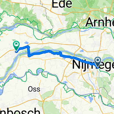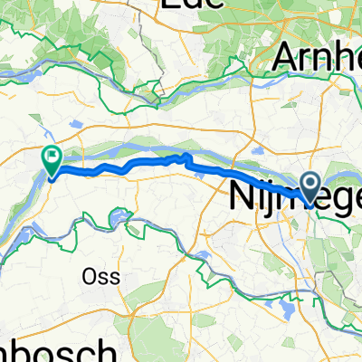
Netherlands trip segment 3 (finale!!) Nijmegen to Amsterdam
- 128.7 km
- 467 m
- 519 m
- Nijmegen, Gelderland, The Netherlands
A cycling route starting in Nijmegen, Gelderland, The Netherlands.
Overview
Rondje vanaf Nijmegen over de dijk aan de noordkant van de Waal tot aan Doornenburg. Daar met de pont oversteken naar Pannerden. Doorfietsen tot aan Hoch Elten, met de klim naar het kerkje bovenop de heuvel. (Mooi uitzicht over Rheintal!) Via de zuidkant van de Waal (Emmerich - Millingen - Beek) weer terug naar Nijmegen.
Klimmen:
Hoch Elten
Randwijckweg in Beek
Bijzonderheden:
Neem geld (EUR 0.70) mee voor het pontje bij Pannerden.
created this 16 years ago
Route quality
Quiet road
24 km
(32 %)
Path
15.7 km
(21 %)
Paved
44.9 km
(60 %)
Unpaved
1.5 km
(2 %)
Asphalt
35.9 km
(48 %)
Paved (undefined)
9 km
(12 %)
Continue with Bikemap
You would like to ride Hoch Elten or customize it for your own trip? Here is what you can do with this Bikemap route:
Free trial for 3 days, or one-time payment. More about Bikemap Premium.
Discover more Premium features.
Get Bikemap PremiumFrom our community
Open it in the app