

2016
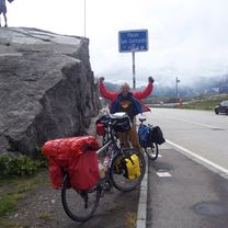
2016 4 Trier - Gotthardpass
A cycling route starting in Neuenburg am Rhein, Baden-Wurttemberg, Germany.
Overview
About this route
Tag 4 2016 Mülheim Neuenburg - Sursee
- -:--
- Duration
- 122.1 km
- Distance
- 718 m
- Ascent
- 430 m
- Descent
- ---
- Avg. speed
- ---
- Max. altitude

Part of
2016
6 stages
Route quality
Waytypes & surfaces along the route
Waytypes
Quiet road
46.4 km
(38 %)
Track
33 km
(27 %)
Surfaces
Paved
78.2 km
(64 %)
Unpaved
31.8 km
(26 %)
Asphalt
76.9 km
(63 %)
Gravel
24.4 km
(20 %)
Continue with Bikemap
Use, edit, or download this cycling route
You would like to ride 2016 4 Trier - Gotthardpass or customize it for your own trip? Here is what you can do with this Bikemap route:
Free features
- Save this route as favorite or in collections
- Copy & plan your own version of this route
- Split it into stages to create a multi-day tour
- Sync your route with Garmin or Wahoo
Premium features
Free trial for 3 days, or one-time payment. More about Bikemap Premium.
- Navigate this route on iOS & Android
- Export a GPX / KML file of this route
- Create your custom printout (try it for free)
- Download this route for offline navigation
Discover more Premium features.
Get Bikemap PremiumFrom our community
Other popular routes starting in Neuenburg am Rhein
 Schleusen des Rheins
- Distance
- 67.9 km
- Ascent
- 93 m
- Descent
- 92 m
- Location
- Neuenburg am Rhein, Baden-Wurttemberg, Germany
 Radtour 2017 Südliche Route
- Distance
- 26.3 km
- Ascent
- 166 m
- Descent
- 167 m
- Location
- Neuenburg am Rhein, Baden-Wurttemberg, Germany
 Nbg-Blansingen-Badenweiler-Laufen-Nbg
- Distance
- 69.9 km
- Ascent
- 690 m
- Descent
- 688 m
- Location
- Neuenburg am Rhein, Baden-Wurttemberg, Germany
 Aufnahme vom 14.04.2017, 17:40
- Distance
- 53.2 km
- Ascent
- 14 m
- Descent
- 14 m
- Location
- Neuenburg am Rhein, Baden-Wurttemberg, Germany
 SRW - Neuenburg - Freiburg
- Distance
- 41 km
- Ascent
- 298 m
- Descent
- 237 m
- Location
- Neuenburg am Rhein, Baden-Wurttemberg, Germany
 Tag5 Neuenburg - Weisweil
- Distance
- 71.8 km
- Ascent
- 87 m
- Descent
- 145 m
- Location
- Neuenburg am Rhein, Baden-Wurttemberg, Germany
 Reben, Rosen, Rhein
- Distance
- 33.4 km
- Ascent
- 247 m
- Descent
- 246 m
- Location
- Neuenburg am Rhein, Baden-Wurttemberg, Germany
 Neuenburger Runde
- Distance
- 35.1 km
- Ascent
- 70 m
- Descent
- 70 m
- Location
- Neuenburg am Rhein, Baden-Wurttemberg, Germany
Open it in the app