

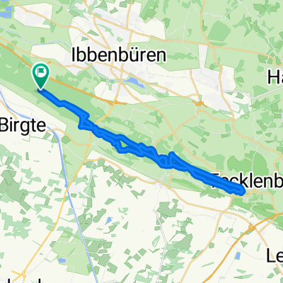
Nasses Dreieck-Tecklenburg
A cycling route starting in Birgte, North Rhine-Westphalia, Germany.
Overview
About this route
The start is the parking lot 'Postweg'.
The tour goes through Brochterbeck (ice cream shop in the town center) to Tecklenburg. Here you can comfortably enjoy a coffee in the old town... and back.
Have fun!!
Elevation according to the GPS (Forerunner 305) 633 m. Please provide feedback if this is correct!
(cloned from route 1075086)
- -:--
- Duration
- 27 km
- Distance
- 445 m
- Ascent
- 445 m
- Descent
- ---
- Avg. speed
- ---
- Max. altitude
Continue with Bikemap
Use, edit, or download this cycling route
You would like to ride Nasses Dreieck-Tecklenburg or customize it for your own trip? Here is what you can do with this Bikemap route:
Free features
- Save this route as favorite or in collections
- Copy & plan your own version of this route
- Sync your route with Garmin or Wahoo
Premium features
Free trial for 3 days, or one-time payment. More about Bikemap Premium.
- Navigate this route on iOS & Android
- Export a GPX / KML file of this route
- Create your custom printout (try it for free)
- Download this route for offline navigation
Discover more Premium features.
Get Bikemap PremiumFrom our community
Other popular routes starting in Birgte
 DEK-Surenburg-Route
- Distance
- 38.5 km
- Ascent
- 79 m
- Descent
- 79 m
- Location
- Birgte, North Rhine-Westphalia, Germany
 Riesenbeck Ems Elte
- Distance
- 50.3 km
- Ascent
- 86 m
- Descent
- 86 m
- Location
- Birgte, North Rhine-Westphalia, Germany
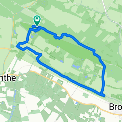
 Nasses Dreieck-Tecklenburg CLONED FROM ROUTE 1075086
- Distance
- 27 km
- Ascent
- 497 m
- Descent
- 500 m
- Location
- Birgte, North Rhine-Westphalia, Germany
 Nasses Dreieck-Tecklenburg
- Distance
- 27 km
- Ascent
- 445 m
- Descent
- 445 m
- Location
- Birgte, North Rhine-Westphalia, Germany
 Hockendes Weib – Dörenther Klippen Runde von Dörenthe
- Distance
- 8.1 km
- Ascent
- 148 m
- Descent
- 149 m
- Location
- Birgte, North Rhine-Westphalia, Germany
 Postweg Runde
- Distance
- 7.6 km
- Ascent
- 94 m
- Descent
- 102 m
- Location
- Birgte, North Rhine-Westphalia, Germany
 Dörenther-Klippen - Camp Regenbögen und zurück
- Distance
- 39.6 km
- Ascent
- 517 m
- Descent
- 517 m
- Location
- Birgte, North Rhine-Westphalia, Germany
 Hockendes Weib
- Distance
- 42.3 km
- Ascent
- 155 m
- Descent
- 157 m
- Location
- Birgte, North Rhine-Westphalia, Germany
Open it in the app