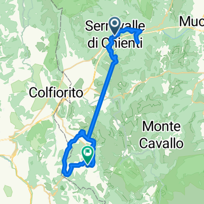
MONTE IGNO E LA VIA DEI SANTI
A cycling route starting in Serravalle di Chienti, The Marches, Italy.
Overview
About this route
A beautiful hike with an ascent to the ridge of Monte Igno, an excellent panoramic balcony over the plains of Montelago and the Chienti valley.
- -:--
- Duration
- 19.9 km
- Distance
- 781 m
- Ascent
- 773 m
- Descent
- ---
- Avg. speed
- ---
- Max. altitude
Continue with Bikemap
Use, edit, or download this cycling route
You would like to ride MONTE IGNO E LA VIA DEI SANTI or customize it for your own trip? Here is what you can do with this Bikemap route:
Free features
- Save this route as favorite or in collections
- Copy & plan your own version of this route
- Sync your route with Garmin or Wahoo
Premium features
Free trial for 3 days, or one-time payment. More about Bikemap Premium.
- Navigate this route on iOS & Android
- Export a GPX / KML file of this route
- Create your custom printout (try it for free)
- Download this route for offline navigation
Discover more Premium features.
Get Bikemap PremiumFrom our community
Other popular routes starting in Serravalle di Chienti
 Colfiorito-Muccia-Pievefavera-Sarnano
- Distance
- 65.6 km
- Ascent
- 1,139 m
- Descent
- 1,383 m
- Location
- Serravalle di Chienti, The Marches, Italy
 2023 ITA Mid 3/6
- Distance
- 138.8 km
- Ascent
- 4,041 m
- Descent
- 3,012 m
- Location
- Serravalle di Chienti, The Marches, Italy
 Piani di Colfiorito
- Distance
- 37.1 km
- Ascent
- 580 m
- Descent
- 585 m
- Location
- Serravalle di Chienti, The Marches, Italy
 Itinerario Chiese Serravalle
- Distance
- 35.7 km
- Ascent
- 1,269 m
- Descent
- 1,055 m
- Location
- Serravalle di Chienti, The Marches, Italy
 Colfiorito - Rasiglia - Ex ferrovia Norcia-Spoleto
- Distance
- 76.1 km
- Ascent
- 764 m
- Descent
- 1,225 m
- Location
- Serravalle di Chienti, The Marches, Italy
 Tirreno Adriatico - tappa 4 Colfiorito - Cingoli
- Distance
- 67.1 km
- Ascent
- 693 m
- Descent
- 886 m
- Location
- Serravalle di Chienti, The Marches, Italy
 R11 Serravalle - Gubbio
- Distance
- 79.1 km
- Ascent
- 1,957 m
- Descent
- 2,098 m
- Location
- Serravalle di Chienti, The Marches, Italy
 monte massa profoglio
- Distance
- 32.5 km
- Ascent
- 791 m
- Descent
- 788 m
- Location
- Serravalle di Chienti, The Marches, Italy
Open it in the app


