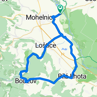
okruh Mohelnice-Maletín-Lázek-Drozd.Pila-Hněvkov-Dolní Bušínov-Mo
- 76.6 km
- 1,691 m
- 1,613 m
- Mohelnice, Olomoucký kraj, Czechia
A cycling route starting in Mohelnice, Olomoucký kraj, Czechia.
Overview
The Google base map is not very accurate in the terrain, here simplified with straight sections, the exact length of the route according to the odometer was 81 km.
created this 17 years ago
Route quality
Road
28.3 km
(37 %)
Track
17.6 km
(23 %)
Paved
17.6 km
(23 %)
Unpaved
10 km
(13 %)
Asphalt
13.8 km
(18 %)
Gravel
4.6 km
(6 %)
Continue with Bikemap
You would like to ride okruh Mohelnice-Maletín-Lázek-Drozd.Pila-Hněvkov-Dolní Bušínov-Mo or customize it for your own trip? Here is what you can do with this Bikemap route:
Free trial for 3 days, or one-time payment. More about Bikemap Premium.
Discover more Premium features.
Get Bikemap PremiumFrom our community
Open it in the app