

🚴♀️E*Bike🇮🇩 16.04.29. 4 Tag Weinstrasse - TRIENT
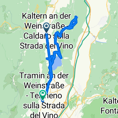
A cycling route starting in Caldaro sulla Strada del Vino, Trentino-Alto Adige, Italy.
Overview
About this route
Wegbeschreibung: Koordinaten: AUER B: 46.354 443 L: 11.280 904
Von St Michael Radwandern über Weindorf AUER zum Kalterer See - Tramin - Kurtasch - Salurner Klause mit Wasserfall - Etschtalradweg nach TRIENT mit Dom
Koordinaten: TRIENT B: 46.069 150 L: 11.115 647
Rückfahrt mit dem Bus zum Hotel.
- -:--
- Duration
- 52.7 km
- Distance
- 292 m
- Ascent
- 470 m
- Descent
- ---
- Avg. speed
- ---
- Max. altitude

Route photos


Route quality
Waytypes & surfaces along the route
Waytypes
Quiet road
21.6 km
(41 %)
Cycleway
16.9 km
(32 %)
Surfaces
Paved
41.1 km
(78 %)
Unpaved
0.5 km
(1 %)
Asphalt
40.6 km
(77 %)
Paved (undefined)
0.5 km
(1 %)
Route highlights
Points of interest along the route

Point of interest after 5 km
Kalterer See
Continue with Bikemap
Use, edit, or download this cycling route
You would like to ride 🚴♀️E*Bike🇮🇩 16.04.29. 4 Tag Weinstrasse - TRIENT or customize it for your own trip? Here is what you can do with this Bikemap route:
Free features
- Save this route as favorite or in collections
- Copy & plan your own version of this route
- Sync your route with Garmin or Wahoo
Premium features
Free trial for 3 days, or one-time payment. More about Bikemap Premium.
- Navigate this route on iOS & Android
- Export a GPX / KML file of this route
- Create your custom printout (try it for free)
- Download this route for offline navigation
Discover more Premium features.
Get Bikemap PremiumFrom our community
Other popular routes starting in Caldaro sulla Strada del Vino
 Marktplatz, Kaltern an der Weinstraße nach Sankt Josef am See, Kaltern an der Weinstraße
- Distance
- 5.5 km
- Ascent
- 27 m
- Descent
- 238 m
- Location
- Caldaro sulla Strada del Vino, Trentino-Alto Adige, Italy
 Marktplatz, Kaltern an der Weinstraße nach St-Valentin-Weg, Tramin an der Weinstraße
- Distance
- 39 km
- Ascent
- 797 m
- Descent
- 951 m
- Location
- Caldaro sulla Strada del Vino, Trentino-Alto Adige, Italy
 Localita' San Giuseppe Al Lago nach Localita' San Giuseppe Al Lago
- Distance
- 29.2 km
- Ascent
- 526 m
- Descent
- 526 m
- Location
- Caldaro sulla Strada del Vino, Trentino-Alto Adige, Italy
 Entiklar
- Distance
- 36.8 km
- Ascent
- 741 m
- Descent
- 742 m
- Location
- Caldaro sulla Strada del Vino, Trentino-Alto Adige, Italy
 Von Kaltern an der Weinstrasse bis Bozen
- Distance
- 17.9 km
- Ascent
- 149 m
- Descent
- 354 m
- Location
- Caldaro sulla Strada del Vino, Trentino-Alto Adige, Italy
 Marktplatz, Kaltern an der Weinstraße nach Montigglerweg, Kaltern an der Weinstraße
- Distance
- 1.5 km
- Ascent
- 40 m
- Descent
- 79 m
- Location
- Caldaro sulla Strada del Vino, Trentino-Alto Adige, Italy
 Route in Kaltern an der Weinstrasse
- Distance
- 102.4 km
- Ascent
- 3,147 m
- Descent
- 3,147 m
- Location
- Caldaro sulla Strada del Vino, Trentino-Alto Adige, Italy
 Von Kaltern an der Weinstrasse bis Tramin an der Weinstrasse
- Distance
- 54.2 km
- Ascent
- 2,657 m
- Descent
- 2,661 m
- Location
- Caldaro sulla Strada del Vino, Trentino-Alto Adige, Italy
Open it in the app