

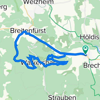
Pfahlbronn-Aichstruter Stausee
A cycling route starting in Alfdorf, Baden-Wurttemberg, Germany.
Overview
About this route
easy ride (cloned from route 3362398)
- -:--
- Duration
- 20.4 km
- Distance
- 160 m
- Ascent
- 160 m
- Descent
- ---
- Avg. speed
- ---
- Max. altitude
Route quality
Waytypes & surfaces along the route
Waytypes
Track
12.7 km
(62 %)
Quiet road
5.3 km
(26 %)
Surfaces
Paved
15.7 km
(77 %)
Unpaved
2.5 km
(12 %)
Asphalt
13.7 km
(67 %)
Paved (undefined)
2 km
(10 %)
Continue with Bikemap
Use, edit, or download this cycling route
You would like to ride Pfahlbronn-Aichstruter Stausee or customize it for your own trip? Here is what you can do with this Bikemap route:
Free features
- Save this route as favorite or in collections
- Copy & plan your own version of this route
- Sync your route with Garmin or Wahoo
Premium features
Free trial for 3 days, or one-time payment. More about Bikemap Premium.
- Navigate this route on iOS & Android
- Export a GPX / KML file of this route
- Create your custom printout (try it for free)
- Download this route for offline navigation
Discover more Premium features.
Get Bikemap PremiumFrom our community
Other popular routes starting in Alfdorf
 Pfahlbronn-Aichstruter Stausee
- Distance
- 20.4 km
- Ascent
- 160 m
- Descent
- 160 m
- Location
- Alfdorf, Baden-Wurttemberg, Germany
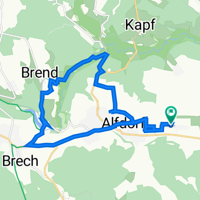
 Moderate Route in Alfdorf
- Distance
- 34.8 km
- Ascent
- 873 m
- Descent
- 873 m
- Location
- Alfdorf, Baden-Wurttemberg, Germany
 Welzheimer Straße 24, Alfdorf nach Länderweg 17/1, Alfdorf
- Distance
- 18.5 km
- Ascent
- 331 m
- Descent
- 331 m
- Location
- Alfdorf, Baden-Wurttemberg, Germany
 Langsame Fahrt in Alfdorf
- Distance
- 10.2 km
- Ascent
- 162 m
- Descent
- 160 m
- Location
- Alfdorf, Baden-Wurttemberg, Germany
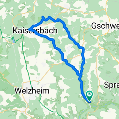 Alfdorf-Menzlesmühle-Kaisersbach-MTB-Rundtour
- Distance
- 26.5 km
- Ascent
- 410 m
- Descent
- 409 m
- Location
- Alfdorf, Baden-Wurttemberg, Germany
 Erich-Klink-Straße 11, Alfdorf nach Erich-Klink-Straße 11, Alfdorf
- Distance
- 12.9 km
- Ascent
- 188 m
- Descent
- 184 m
- Location
- Alfdorf, Baden-Wurttemberg, Germany
 Welzheimer Straße 24, Alfdorf nach Länderweg 17/1, Alfdorf
- Distance
- 13.3 km
- Ascent
- 113 m
- Descent
- 109 m
- Location
- Alfdorf, Baden-Wurttemberg, Germany
 Langsame Fahrt in Alfdorf
- Distance
- 43.1 km
- Ascent
- 734 m
- Descent
- 679 m
- Location
- Alfdorf, Baden-Wurttemberg, Germany
Open it in the app